Surin geodata
Surin (Nouvelle-Aquitaine) is a populated place; located in France in Europe/Paris (GMT+2) time zone. With population of 531 people, there are 14589 cities with bigger population in this country. Compared to other cities in France, 60.5% of cities are located further ↑North; 82.9% of cities are located further →East and 63.6% of cities have higher elevation than Surin. Note1
Administrative division(s):
- Level 1: Nouvelle-Aquitaine
- Level 2: Département des Deux-Sèvres
- Level 3: Arrondissement de Parthenay
- Level 4: Surin


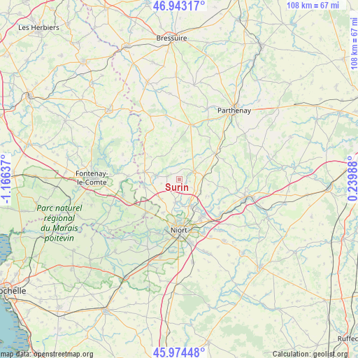
Surin GPS coordinates[2]
46° 27' 39.528" North, 0° 27' 47.664" West
| Map corner | latitude | longitude |
|---|---|---|
| Upper-left | 46.94317°, | -1.16637° |
| Center: | 46.46098°, | -0.46324° |
| Lower-right: | 45.97448°, | 0.23988° |
| Map W x H: | 107.7×107.7 km | = 66.9×66.9mi |
| max Lat: | 51.07786° ⇑60.5% North |
| Surin: | 46.46098° |
| min Lat: | ⇓39.5% South 41.3874° |
| min Long | Surin | max Long |
| -5.08615° | -0.46324° | 9.52242° |
| W 17.1%⇐ | ⇒82.9% E |
Elevation
Elevation of Surin is 93 m = 305 ft, and this is 100.7 m = 330 ft below average elevation for this country.
| Max E: |
2333 m = 7654 ft | 63.6% |
| Avg. | 193.7 m = 635 ft | |
| Surin | 93 m = 305 ft | |
Min E: |
-1 m = -3 ft | 36.4% |
See also: France elevation on elevation.city.
Geographical zone
Surin is located in North temperate zone (between Tropic of Cancer and the Arctic Circle). Distance of this North polar circle is 2235.2 km =1388.9 mi to North.| Distance of | km | miles | from Surin |
|---|---|---|---|
| North Pole | 4841.1 | 3008.1 | to North |
| Arctic Circle | 2235.2 | 1388.9 | to North |
| Tropic Cancer | 2560.1 | 1590.8 | to South |
| Equator | 5166 | 3210 | to South |


Nearby cities:
15 places around Surin: (largest is in red/bold)
• Ardin
7.4 km =4.6 mi,  281°
281°
• Béceleuf
3.5 km =2.2 mi,  289°
289°
• Champdeniers-Saint-Denis
5.4 km =3.4 mi,  62°
62°
• Chauray
12.9 km =8 mi,  149°
149°
• Cherveux
9.6 km =6 mi,  121°
121°
• Coulonges-sur-l’Autize
10.7 km =6.6 mi, 283°
• Germond-Rouvre
3.8 km =2.4 mi,  108°
108°
• Saint-Gelais
10.3 km =6.4 mi, 147°
• Saint-Maxire
6.9 km =4.3 mi,  189°
189°
• Saint-Pompain
10.7 km =6.6 mi,  258°
258°
• Saint-Rémy
11.2 km =7 mi,  206°
206°
• Sainte-Ouenne
2.3 km =1.4 mi,  142°
142°
• Sciecq
9.8 km =6.1 mi,  183°
183°
• Villiers-en-Plaine
8.1 km =5 mi,  224°
224°
• Échiré
8.7 km =5.4 mi,  155°
155°
Sources, notices
• [Note1] Compared only with cities in France existing in our database
• [Src1] Map data: © OpenStreetMap contributors (CC-BY-SA)
• [Src2] Other city data from geonames.org with taken over terms of usage.
• [Src3] Geographical zone / Annual Mean Temperature by Robert A. Rohde @ Wikipedia
