Dugny geodata
Dugny (Île-de-France) is a populated place; located in France in Europe/Paris (GMT+2) time zone. With population of 10,709 people, there are 894 cities with bigger population in this country. Compared to other cities in France, 78.7% of cities are located further ↓South; 50.8% of cities are located further →East and 84.1% of cities have higher elevation than Dugny. Note1
Administrative division(s):
- Level 1: Île-de-France
- Level 2: Seine-Saint-Denis
- Level 3: Arrondissement du Raincy
- Level 4: Dugny


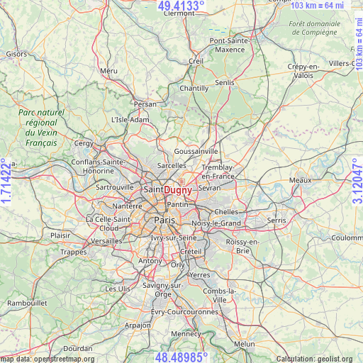
Dugny GPS coordinates[2]
48° 57' 13.356" North, 2° 25' 2.424" East
| Map corner | latitude | longitude |
|---|---|---|
| Upper-left | 49.4133°, | 1.71422° |
| Center: | 48.95371°, | 2.41734° |
| Lower-right: | 48.48985°, | 3.12047° |
| Map W x H: | 102.7×102.7 km | = 63.8×63.8mi |
| max Lat: | 51.07786° ⇑21.3% North |
| Dugny: | 48.95371° |
| min Lat: | ⇓78.7% South 41.3874° |
| min Long | Dugny | max Long |
| -5.08615° | 2.41734° | 9.52242° |
| W 49.2%⇐ | ⇒50.8% E |
Elevation
Elevation of Dugny is 44 m = 144 ft, and this is 149.7 m = 491 ft below average elevation for this country.
| Max E: |
2333 m = 7654 ft | 84.1% |
| Avg. | 193.7 m = 635 ft | |
| Dugny | 44 m = 144 ft | |
Min E: |
-1 m = -3 ft | 15.9% |
See also: France elevation on elevation.city.
Geographical zone
Dugny is located in North temperate zone (between Tropic of Cancer and the Arctic Circle). Distance of this North polar circle is 1958 km =1216.6 mi to North.| Distance of | km | miles | from Dugny |
|---|---|---|---|
| North Pole | 4563.9 | 2835.9 | to North |
| Arctic Circle | 1958 | 1216.6 | to North |
| Tropic Cancer | 2837.2 | 1763 | to South |
| Equator | 5443.1 | 3382.2 | to South |


Nearby cities:
15 places around Dugny: (largest is in red/bold)
• Arnouville
3.3 km =2.1 mi,  359°
359°
• Aubervilliers
4.8 km =3 mi,  211°
211°
• Bobigny
5.4 km =3.4 mi,  153°
153°
• Bonneuil-en-France
2.5 km =1.6 mi,  24°
24°
• Drancy
3.7 km =2.3 mi, 146°
• Garges-lès-Gonesse
2.1 km =1.3 mi,  317°
317°
• Gonesse
4.4 km =2.7 mi,  31°
31°
• La Courneuve
3.2 km =2 mi, 208°
• Le Blanc-Mesnil
3.6 km =2.2 mi,  117°
117°
• Le Bourget
2.6 km =1.6 mi, 148°
• Montmagny
5.6 km =3.5 mi,  293°
293°
• Pierrefitte-sur-Seine
4.4 km =2.7 mi, 289°
• Saint-Denis
5.1 km =3.2 mi,  246°
246°
• Stains
2.5 km =1.6 mi,  260°
260°
• Villetaneuse
5.5 km =3.4 mi,  275°
275°
Sources, notices
• [Note1] Compared only with cities in France existing in our database
• [Src1] Map data: © OpenStreetMap contributors (CC-BY-SA)
• [Src2] Other city data from geonames.org with taken over terms of usage.
• [Src3] Geographical zone / Annual Mean Temperature by Robert A. Rohde @ Wikipedia
