Entrains-sur-Nohain geodata
Entrains-sur-Nohain (Bourgogne-Franche-Comté) is a populated place; located in France in Europe/Paris (GMT+2) time zone. With population of 971 people, there are 9054 cities with bigger population in this country. Compared to other cities in France, 50.7% of cities are located further ↓South; 61.4% of cities are located further ←West and 71% of cities have lower elevation than Entrains-sur-Nohain. Note1
Administrative division(s):
- Level 1: Bourgogne-Franche-Comté
- Level 2: Département de la Nièvre
- Level 3: Arrondissement de Clamecy
- Level 4: Entrains-sur-Nohain


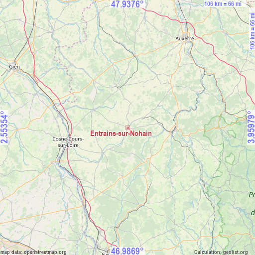
Entrains-sur-Nohain GPS coordinates[2]
47° 27' 51.84" North, 3° 15' 23.976" East
| Map corner | latitude | longitude |
|---|---|---|
| Upper-left | 47.9376°, | 2.55354° |
| Center: | 47.4644°, | 3.25666° |
| Lower-right: | 46.9869°, | 3.95979° |
| Map W x H: | 105.7×105.7 km | = 65.7×65.7mi |
| max Lat: | 51.07786° ⇑49.3% North |
| Entrains-sur-Nohain: | 47.4644° |
| min Lat: | ⇓50.7% South 41.3874° |
| min Long | Entrains-sur-No | max Long |
| -5.08615° | 3.25666° | 9.52242° |
| W 61.4%⇐ | ⇒38.6% E |
Elevation
Elevation of Entrains-sur-Nohain is 224 m = 735 ft, and this is 30.3 m = 99 ft above average elevation for this country.
| Max E: |
2333 m = 7654 ft | 29% |
| Entrains-sur-Nohain | 224 m 735 ft | |
| Avg. | 193.7 m = 635 ft | |
Min E: |
-1 m = -3 ft | 71% |
See also: France elevation on elevation.city.
Geographical zone
Entrains-sur-Nohain is located in North temperate zone (between Tropic of Cancer and the Arctic Circle). Distance of this North polar circle is 2123.6 km =1319.5 mi to North.| Distance of | km | miles | from Entrains-sur-Nohain |
|---|---|---|---|
| North Pole | 4729.5 | 2938.8 | to North |
| Arctic Circle | 2123.6 | 1319.5 | to North |
| Tropic Cancer | 2671.6 | 1660.1 | to South |
| Equator | 5277.5 | 3279.3 | to South |


Nearby cities:
15 places around Entrains-sur-Nohain: (largest is in red/bold)
• Alligny-Cosne
14.8 km =9.2 mi,  265°
265°
• Arquian
22 km =13.7 mi,  293°
293°
• Châteauneuf-Val-de-Bargis
20.4 km =12.7 mi,  186°
186°
• Clamecy
19.8 km =12.3 mi,  91°
91°
• Coulanges-sur-Yonne
22.4 km =13.9 mi,  71°
71°
• Donzy
14.4 km =8.9 mi,  223°
223°
• Fontenailles
18.1 km =11.2 mi,  58°
58°
• Saint-Amand-en-Puisaye
15.5 km =9.6 mi,  297°
297°
• Saint-Fargeau
24.1 km =15 mi,  324°
324°
• Saint-Sauveur-en-Puisaye
17.7 km =11 mi,  345°
345°
• Saints-en-Puisaye
17.4 km =10.8 mi,  1°
1°
• Suilly-la-Tour
20.2 km =12.6 mi,  225°
225°
• Treigny
11 km =6.8 mi,  329°
329°
• Varzy
15.3 km =9.5 mi,  140°
140°
• Étais-la-Sauvin
8 km =5 mi, 56°
Sources, notices
• [Note1] Compared only with cities in France existing in our database
• [Src1] Map data: © OpenStreetMap contributors (CC-BY-SA)
• [Src2] Other city data from geonames.org with taken over terms of usage.
• [Src3] Geographical zone / Annual Mean Temperature by Robert A. Rohde @ Wikipedia
