Crugny geodata
Crugny (Grand Est) is a populated place; located in France in Europe/Paris (GMT+2) time zone. With population of 610 people, there are 13160 cities with bigger population in this country. Compared to other cities in France, 85.3% of cities are located further ↓South; 66% of cities are located further ←West and 69.7% of cities have higher elevation than Crugny. Note1
Administrative division(s):
- Level 1: Grand Est
- Level 2: Marne
- Level 3: Arrondissement de Reims
- Level 4: Crugny


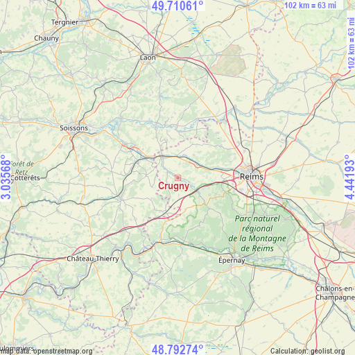
Crugny GPS coordinates[2]
49° 15' 13.716" North, 3° 44' 19.716" East
| Map corner | latitude | longitude |
|---|---|---|
| Upper-left | 49.71061°, | 3.03568° |
| Center: | 49.25381°, | 3.73881° |
| Lower-right: | 48.79274°, | 4.44193° |
| Map W x H: | 102.1×102.1 km | = 63.4×63.4mi |
| max Lat: | 51.07786° ⇑14.7% North |
| Crugny: | 49.25381° |
| min Lat: | ⇓85.3% South 41.3874° |
| min Long | Crugny | max Long |
| -5.08615° | 3.73881° | 9.52242° |
| W 66%⇐ | ⇒34% E |
Elevation
Elevation of Crugny is 79 m = 259 ft, and this is 114.7 m = 376 ft below average elevation for this country.
| Max E: |
2333 m = 7654 ft | 69.7% |
| Avg. | 193.7 m = 635 ft | |
| Crugny | 79 m = 259 ft | |
Min E: |
-1 m = -3 ft | 30.3% |
See also: France elevation on elevation.city.
Geographical zone
Crugny is located in North temperate zone (between Tropic of Cancer and the Arctic Circle). Distance of this North polar circle is 1924.7 km =1196 mi to North.| Distance of | km | miles | from Crugny |
|---|---|---|---|
| North Pole | 4530.6 | 2815.2 | to North |
| Arctic Circle | 1924.7 | 1196 | to North |
| Tropic Cancer | 2870.6 | 1783.7 | to South |
| Equator | 5476.5 | 3402.9 | to South |


Nearby cities:
15 places around Crugny: (largest is in red/bold)
• Beaurieux
15.5 km =9.6 mi,  0°
0°
• Bourg-et-Comin
17 km =10.6 mi,  338°
338°
• Champigny
16.9 km =10.5 mi,  84°
84°
• Châtillon-sur-Marne
17.1 km =10.6 mi,  174°
174°
• Fismes
7.1 km =4.4 mi,  327°
327°
• Gueux
12.4 km =7.7 mi,  91°
91°
• Hermonville
15.5 km =9.6 mi,  53°
53°
• Jonchery-sur-Vesle
6.7 km =4.2 mi, 53°
• Les Mesneux
16.6 km =10.3 mi,  103°
103°
• Merfy
16 km =9.9 mi,  72°
72°
• Mont-Notre-Dame
12.1 km =7.5 mi,  292°
292°
• Muizon
11.3 km =7 mi, 77°
• Prouilly
9.8 km =6.1 mi,  57°
57°
• Trigny
12.6 km =7.8 mi, 64°
• Ville-en-Tardenois
9.3 km =5.8 mi,  151°
151°
Sources, notices
• [Note1] Compared only with cities in France existing in our database
• [Src1] Map data: © OpenStreetMap contributors (CC-BY-SA)
• [Src2] Other city data from geonames.org with taken over terms of usage.
• [Src3] Geographical zone / Annual Mean Temperature by Robert A. Rohde @ Wikipedia
