Beaurieux geodata
Beaurieux (Hauts-de-France) is a populated place; located in France in Europe/Paris (GMT+2) time zone. With population of 708 people, there are 11684 cities with bigger population in this country. Compared to other cities in France, 87.8% of cities are located further ↓South; 66% of cities are located further ←West and 63.6% of cities have higher elevation than Beaurieux. Note1
Administrative division(s):
- Level 1: Hauts-de-France
- Level 2: Département de l'Aisne
- Level 3: Arrondissement de Laon
- Level 4: Beaurieux


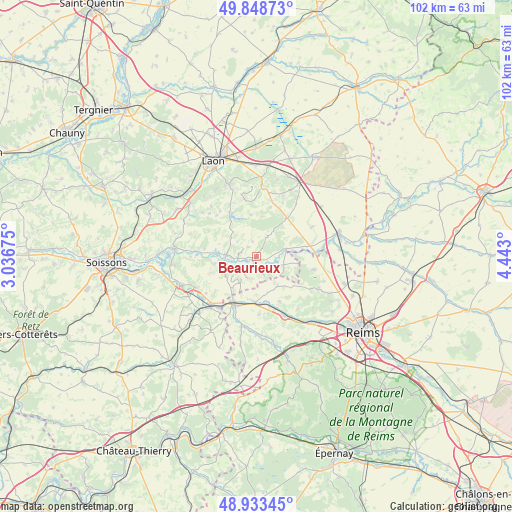
Beaurieux GPS coordinates[2]
49° 23' 35.592" North, 3° 44' 23.568" East
| Map corner | latitude | longitude |
|---|---|---|
| Upper-left | 49.84873°, | 3.03675° |
| Center: | 49.39322°, | 3.73988° |
| Lower-right: | 48.93345°, | 4.443° |
| Map W x H: | 101.8×101.8 km | = 63.3×63.3mi |
| max Lat: | 51.07786° ⇑12.2% North |
| Beaurieux: | 49.39322° |
| min Lat: | ⇓87.8% South 41.3874° |
| min Long | Beaurieux | max Long |
| -5.08615° | 3.73988° | 9.52242° |
| W 66%⇐ | ⇒34% E |
Elevation
Elevation of Beaurieux is 93 m = 305 ft, and this is 100.7 m = 330 ft below average elevation for this country.
| Max E: |
2333 m = 7654 ft | 63.6% |
| Avg. | 193.7 m = 635 ft | |
| Beaurieux | 93 m = 305 ft | |
Min E: |
-1 m = -3 ft | 36.4% |
See also: France elevation on elevation.city.
Geographical zone
Beaurieux is located in North temperate zone (between Tropic of Cancer and the Arctic Circle). Distance of this North polar circle is 1909.2 km =1186.3 mi to North.| Distance of | km | miles | from Beaurieux |
|---|---|---|---|
| North Pole | 4515.1 | 2805.6 | to North |
| Arctic Circle | 1909.2 | 1186.3 | to North |
| Tropic Cancer | 2886.1 | 1793.3 | to South |
| Equator | 5492 | 3412.6 | to South |


Nearby cities:
15 places around Beaurieux: (largest is in red/bold)
• Berry-au-Bac
11.7 km =7.3 mi,  84°
84°
• Bourg-et-Comin
6.2 km =3.9 mi,  273°
273°
• Braine
16 km =9.9 mi,  249°
249°
• Bruyères-et-Montbérault
15.7 km =9.8 mi,  339°
339°
• Corbeny
9.8 km =6.1 mi,  37°
37°
• Cormicy
11.6 km =7.2 mi,  102°
102°
• Crugny
15.5 km =9.6 mi,  180°
180°
• Festieux
14.4 km =8.9 mi,  4°
4°
• Fismes
10.3 km =6.4 mi,  202°
202°
• Hermonville
13.8 km =8.6 mi,  117°
117°
• Jonchery-sur-Vesle
12.7 km =7.9 mi,  155°
155°
• Mont-Notre-Dame
15.6 km =9.7 mi,  226°
226°
• Prouilly
13.2 km =8.2 mi,  141°
141°
• Saint-Erme-Outre-et-Ramecourt
15.3 km =9.5 mi,  28°
28°
• Trigny
15.1 km =9.4 mi,  131°
131°
Sources, notices
• [Note1] Compared only with cities in France existing in our database
• [Src1] Map data: © OpenStreetMap contributors (CC-BY-SA)
• [Src2] Other city data from geonames.org with taken over terms of usage.
• [Src3] Geographical zone / Annual Mean Temperature by Robert A. Rohde @ Wikipedia
