Créon geodata
Créon (Nouvelle-Aquitaine) is a populated place; located in France in Europe/Paris (GMT+2) time zone. With population of 3,139 people, there are 3101 cities with bigger population in this country. Compared to other cities in France, 81.6% of cities are located further ↑North; 81.3% of cities are located further →East and 59.4% of cities have higher elevation than Créon. Note1
Administrative division(s):
- Level 1: Nouvelle-Aquitaine
- Level 2: Gironde
- Level 3: Arrondissement de Bordeaux
- Level 4: Créon


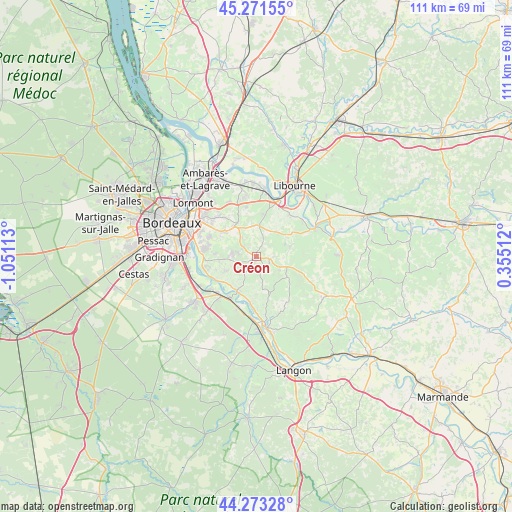
Créon GPS coordinates[2]
44° 46' 28.452" North, 0° 20' 52.8" West
| Map corner | latitude | longitude |
|---|---|---|
| Upper-left | 45.27155°, | -1.05113° |
| Center: | 44.77457°, | -0.348° |
| Lower-right: | 44.27328°, | 0.35512° |
| Map W x H: | 111×111 km | = 69×69mi |
| max Lat: | 51.07786° ⇑81.6% North |
| Créon: | 44.77457° |
| min Lat: | ⇓18.4% South 41.3874° |
| min Long | Créon | max Long |
| -5.08615° | -0.348° | 9.52242° |
| W 18.7%⇐ | ⇒81.3% E |
Elevation
Elevation of Créon is 104 m = 341 ft, and this is 89.7 m = 294 ft below average elevation for this country.
| Max E: |
2333 m = 7654 ft | 59.4% |
| Avg. | 193.7 m = 635 ft | |
| Créon | 104 m = 341 ft | |
Min E: |
-1 m = -3 ft | 40.6% |
See also: France elevation on elevation.city.
Geographical zone
Créon is located in North temperate zone (between Tropic of Cancer and the Arctic Circle). Distance of this Northern Tropic circle is 2372.5 km =1474.2 mi to South.| Distance of | km | miles | from Créon |
|---|---|---|---|
| North Pole | 5028.6 | 3124.6 | to North |
| Arctic Circle | 2422.7 | 1505.4 | to North |
| Tropic Cancer | 2372.5 | 1474.2 | to South |
| Equator | 4978.5 | 3093.5 | to South |


Nearby cities:
15 places around Créon: (largest is in red/bold)
• Baron
6 km =3.7 mi,  28°
28°
• Bonnetan
7 km =4.3 mi,  310°
310°
• Camarsac
6.5 km =4 mi,  349°
349°
• Capian
7.2 km =4.5 mi,  168°
168°
• Espiet
7.5 km =4.7 mi,  64°
64°
• Haux
4.7 km =2.9 mi,  202°
202°
• La Sauve
2.6 km =1.6 mi,  109°
109°
• Lignan-de-Bordeaux
6.8 km =4.2 mi,  291°
291°
• Loupes
5 km =3.1 mi,  321°
321°
• Sadirac
5.2 km =3.2 mi,  278°
278°
• Saint-Caprais-de-Bordeaux
7.3 km =4.5 mi,  245°
245°
• Saint-Quentin-de-Baron
6.9 km =4.3 mi,  45°
45°
• Sallebœuf
7.7 km =4.8 mi,  327°
327°
• Tabanac
7.5 km =4.7 mi,  216°
216°
• Targon
8 km =5 mi,  123°
123°
Sources, notices
• [Note1] Compared only with cities in France existing in our database
• [Src1] Map data: © OpenStreetMap contributors (CC-BY-SA)
• [Src2] Other city data from geonames.org with taken over terms of usage.
• [Src3] Geographical zone / Annual Mean Temperature by Robert A. Rohde @ Wikipedia
