Coussac-Bonneval geodata
Coussac-Bonneval (Nouvelle-Aquitaine) is a populated place; located in France in Europe/Paris (GMT+2) time zone. With population of 1,423 people, there are 6511 cities with bigger population in this country. Compared to other cities in France, 74% of cities are located further ↑North; 65.3% of cities are located further →East and 85% of cities have lower elevation than Coussac-Bonneval. Note1
Administrative division(s):
- Level 1: Nouvelle-Aquitaine
- Level 2: Haute-Vienne
- Level 3: Arrondissement de Limoges
- Level 4: Coussac-Bonneval


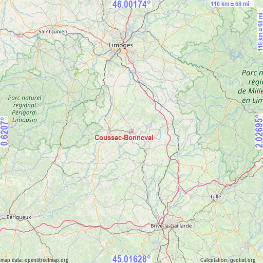
Coussac-Bonneval GPS coordinates[2]
45° 30' 40.212" North, 1° 19' 25.752" East
| Map corner | latitude | longitude |
|---|---|---|
| Upper-left | 46.00174°, | 0.6207° |
| Center: | 45.51117°, | 1.32382° |
| Lower-right: | 45.01628°, | 2.02695° |
| Map W x H: | 109.6×109.6 km | = 68.1×68.1mi |
| max Lat: | 51.07786° ⇑74% North |
| Coussac-Bonneval: | 45.51117° |
| min Lat: | ⇓26% South 41.3874° |
| min Long | Coussac-Bonneva | max Long |
| -5.08615° | 1.32382° | 9.52242° |
| W 34.7%⇐ | ⇒65.3% E |
Elevation
Elevation of Coussac-Bonneval is 346 m = 1135 ft, and this is 152.3 m = 500 ft above average elevation for this country.
| Max E: |
2333 m = 7654 ft | 15% |
| Coussac-Bonneval | 346 m 1135 ft | |
| Avg. | 193.7 m = 635 ft | |
Min E: |
-1 m = -3 ft | 85% |
See also: France elevation on elevation.city.
Geographical zone
Coussac-Bonneval is located in North temperate zone (between Tropic of Cancer and the Arctic Circle). Distance of this North polar circle is 2340.8 km =1454.5 mi to North.| Distance of | km | miles | from Coussac-Bonneval |
|---|---|---|---|
| North Pole | 4946.7 | 3073.7 | to North |
| Arctic Circle | 2340.8 | 1454.5 | to North |
| Tropic Cancer | 2454.4 | 1525.1 | to South |
| Equator | 5060.4 | 3144.4 | to South |


Nearby cities:
15 places around Coussac-Bonneval: (largest is in red/bold)
• Arnac-Pompadour
11.8 km =7.3 mi,  162°
162°
• Château-Chervix
10.9 km =6.8 mi,  12°
12°
• Glandon
8.4 km =5.2 mi,  245°
245°
• La Meyze
14.5 km =9 mi,  323°
323°
• Lubersac
9.7 km =6 mi,  139°
139°
• Magnac-Bourg
14.5 km =9 mi,  35°
35°
• Masseret
15.8 km =9.8 mi,  76°
76°
• Meuzac
10.2 km =6.3 mi,  62°
62°
• Payzac
14.9 km =9.3 mi,  214°
214°
• Saint-Priest-Ligoure
15.8 km =9.8 mi,  350°
350°
• Saint-Sornin-Lavolps
15.5 km =9.6 mi, 162°
• Saint-Yrieix-la-Perche
9.4 km =5.8 mi,  272°
272°
• Salon-la-Tour
16.7 km =10.4 mi,  92°
92°
• Troche
16.5 km =10.3 mi,  146°
146°
• Vicq-sur-Breuilh
15.7 km =9.8 mi,  16°
16°
Sources, notices
• [Note1] Compared only with cities in France existing in our database
• [Src1] Map data: © OpenStreetMap contributors (CC-BY-SA)
• [Src2] Other city data from geonames.org with taken over terms of usage.
• [Src3] Geographical zone / Annual Mean Temperature by Robert A. Rohde @ Wikipedia
