Villefargeau geodata
Villefargeau (Bourgogne-Franche-Comté) is a populated place; located in France in Europe/Paris (GMT+2) time zone. With population of 941 people, there are 9290 cities with bigger population in this country. Compared to other cities in France, 55.5% of cities are located further ↓South; 64.3% of cities are located further ←West and 53.3% of cities have lower elevation than Villefargeau. Note1
Administrative division(s):
- Level 1: Bourgogne-Franche-Comté
- Level 2: Département de l'Yonne
- Level 3: Auxerre
- Level 4: Villefargeau


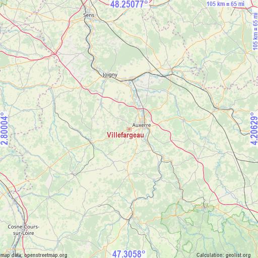
Villefargeau GPS coordinates[2]
47° 46' 49.548" North, 3° 30' 11.376" East
| Map corner | latitude | longitude |
|---|---|---|
| Upper-left | 48.25077°, | 2.80004° |
| Center: | 47.78043°, | 3.50316° |
| Lower-right: | 47.3058°, | 4.20629° |
| Map W x H: | 105.1×105.1 km | = 65.3×65.3mi |
| max Lat: | 51.07786° ⇑44.5% North |
| Villefargeau: | 47.78043° |
| min Lat: | ⇓55.5% South 41.3874° |
| min Long | Villefargeau | max Long |
| -5.08615° | 3.50316° | 9.52242° |
| W 64.3%⇐ | ⇒35.7% E |
Elevation
Elevation of Villefargeau is 144 m = 472 ft, and this is 49.7 m = 163 ft below average elevation for this country.
| Max E: |
2333 m = 7654 ft | 46.7% |
| Avg. | 193.7 m = 635 ft | |
| Villefargeau | 144 m = 472 ft | |
Min E: |
-1 m = -3 ft | 53.3% |
See also: France elevation on elevation.city.
Geographical zone
Villefargeau is located in North temperate zone (between Tropic of Cancer and the Arctic Circle). Distance of this North polar circle is 2088.5 km =1297.7 mi to North.| Distance of | km | miles | from Villefargeau |
|---|---|---|---|
| North Pole | 4694.4 | 2917 | to North |
| Arctic Circle | 2088.5 | 1297.7 | to North |
| Tropic Cancer | 2706.8 | 1681.9 | to South |
| Equator | 5312.7 | 3301.2 | to South |


Nearby cities:
15 places around Villefargeau: (largest is in red/bold)
• Appoigny
10.6 km =6.6 mi,  8°
8°
• Augy
8.2 km =5.1 mi,  101°
101°
• Auxerre
5.5 km =3.4 mi,  66°
66°
• Champs-sur-Yonne
8.9 km =5.5 mi,  125°
125°
• Charbuy
5.5 km =3.4 mi,  329°
329°
• Diges
9.8 km =6.1 mi,  233°
233°
• Escamps
6.1 km =3.8 mi,  201°
201°
• Escolives-Sainte-Camille
10.5 km =6.5 mi, 131°
• Fleury-la-Vallée
10.4 km =6.5 mi,  337°
337°
• Lindry
6.8 km =4.2 mi,  289°
289°
• Monéteau
9.6 km =6 mi,  37°
37°
• Pourrain
7.3 km =4.5 mi,  248°
248°
• Saint-Georges-sur-Baulche
3.1 km =1.9 mi, 43°
• Vallan
4.8 km =3 mi,  146°
146°
• Venoy
10.4 km =6.5 mi, 74°
Sources, notices
• [Note1] Compared only with cities in France existing in our database
• [Src1] Map data: © OpenStreetMap contributors (CC-BY-SA)
• [Src2] Other city data from geonames.org with taken over terms of usage.
• [Src3] Geographical zone / Annual Mean Temperature by Robert A. Rohde @ Wikipedia
