Conflans-Sainte-Honorine geodata
Conflans-Sainte-Honorine (Île-de-France) is a populated place; located in France in Europe/Paris (GMT+2) time zone. With population of 36,358 people, there are 210 cities with bigger population in this country. Compared to other cities in France, 79.7% of cities are located further ↓South; 55.9% of cities are located further →East and 82.6% of cities have higher elevation than Conflans-Sainte-Honorine. Note1
Administrative division(s):
- Level 1: Île-de-France
- Level 2: Yvelines
- Level 3: Arrondissement de Saint-Germain-en-Laye
- Level 4: Conflans-Sainte-Honorine
Current local time in Conflans-Sainte-Honorine:
04:35 AM, WednesdayDifference from your time zone: hours


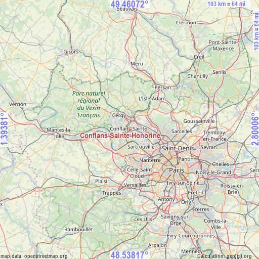
Conflans-Sainte-Honorine GPS coordinates[2]
49° 0' 5.688" North, 2° 5' 48.984" East
| Map corner | latitude | longitude |
|---|---|---|
| Upper-left | 49.46072°, | 1.39381° |
| Center: | 49.00158°, | 2.09694° |
| Lower-right: | 48.53817°, | 2.80006° |
| Map W x H: | 102.6×102.6 km | = 63.8×63.8mi |
| max Lat: | 51.07786° ⇑20.3% North |
| Conflans-Sainte-Honorine: | 49.00158° |
| min Lat: | ⇓79.7% South 41.3874° |
| min Long | Conflans-Sainte | max Long |
| -5.08615° | 2.09694° | 9.52242° |
| W 44.1%⇐ | ⇒55.9% E |
Elevation
Elevation of Conflans-Sainte-Honorine is 48 m = 157 ft, and this is 145.7 m = 478 ft below average elevation for this country.
| Max E: |
2333 m = 7654 ft | 82.6% |
| Avg. | 193.7 m = 635 ft | |
| Conflans-Sainte-Honorine | 48 m = 157 ft | |
Min E: |
-1 m = -3 ft | 17.4% |
See also: France elevation on elevation.city.
Geographical zone
Conflans-Sainte-Honorine is located in North temperate zone (between Tropic of Cancer and the Arctic Circle). Distance of this North polar circle is 1952.7 km =1213.4 mi to North.| Distance of | km | miles | from Conflans-Sainte-Honorine |
|---|---|---|---|
| North Pole | 4558.6 | 2832.6 | to North |
| Arctic Circle | 1952.7 | 1213.4 | to North |
| Tropic Cancer | 2842.5 | 1766.2 | to South |
| Equator | 5448.5 | 3385.5 | to South |


Nearby cities:
15 places around Conflans-Sainte-Honorine: (largest is in red/bold)
• Achères
4.9 km =3 mi,  204°
204°
• Andrésy
3.6 km =2.2 mi,  233°
233°
• Cergy
4.2 km =2.6 mi,  338°
338°
• Cergy-Pontoise
4.4 km =2.7 mi, 341°
• Chanteloup-les-Vignes
5.5 km =3.4 mi,  238°
238°
• Herblay
5.5 km =3.4 mi,  103°
103°
• Jouy-le-Moutier
4.3 km =2.7 mi,  283°
283°
• La Frette-sur-Seine
6.4 km =4 mi,  111°
111°
• Maurecourt
2.7 km =1.7 mi,  256°
256°
• Neuville-sur-Oise
2.8 km =1.7 mi,  307°
307°
• Pierrelaye
4.7 km =2.9 mi,  62°
62°
• Pontoise
5.4 km =3.4 mi,  2°
2°
• Saint-Ouen-l’Aumône
5 km =3.1 mi,  20°
20°
• Vauréal
5.8 km =3.6 mi, 307°
• Éragny
1.7 km =1.1 mi,  7°
7°
Sources, notices
• [Note1] Compared only with cities in France existing in our database
• [Src1] Map data: © OpenStreetMap contributors (CC-BY-SA)
• [Src2] Other city data from geonames.org with taken over terms of usage.
• [Src3] Geographical zone / Annual Mean Temperature by Robert A. Rohde @ Wikipedia
