Clères geodata
Clères (Normandy) is a populated place; located in France in Europe/Paris (GMT+2) time zone. With population of 1,298 people, there are 7038 cities with bigger population in this country. Compared to other cities in France, 90.6% of cities are located further ↓South; 67.7% of cities are located further →East and 63.2% of cities have higher elevation than Clères. Note1
Administrative division(s):
- Level 1: Normandy
- Level 2: Seine-Maritime
- Level 3: Arrondissement de Rouen
- Level 4: Clères


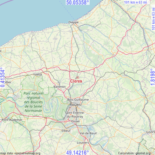
Clères GPS coordinates[2]
49° 36' 0" North, 1° 7' 0.012" East
| Map corner | latitude | longitude |
|---|---|---|
| Upper-left | 50.05358°, | 0.41354° |
| Center: | 49.6°, | 1.11667° |
| Lower-right: | 49.14216°, | 1.8198° |
| Map W x H: | 101.3×101.3 km | = 62.9×62.9mi |
| max Lat: | 51.07786° ⇑9.4% North |
| Clères: | 49.6° |
| min Lat: | ⇓90.6% South 41.3874° |
| min Long | Clères | max Long |
| -5.08615° | 1.11667° | 9.52242° |
| W 32.3%⇐ | ⇒67.7% E |
Elevation
Elevation of Clères is 94 m = 308 ft, and this is 99.7 m = 327 ft below average elevation for this country.
| Max E: |
2333 m = 7654 ft | 63.2% |
| Avg. | 193.7 m = 635 ft | |
| Clères | 94 m = 308 ft | |
Min E: |
-1 m = -3 ft | 36.8% |
See also: France elevation on elevation.city.
Geographical zone
Clères is located in North temperate zone (between Tropic of Cancer and the Arctic Circle). Distance of this North polar circle is 1886.2 km =1172 mi to North.| Distance of | km | miles | from Clères |
|---|---|---|---|
| North Pole | 4492.1 | 2791.3 | to North |
| Arctic Circle | 1886.2 | 1172 | to North |
| Tropic Cancer | 2909.1 | 1807.6 | to South |
| Equator | 5515 | 3426.9 | to South |


Nearby cities:
15 places around Clères: (largest is in red/bold)
• Anceaumeville
5.7 km =3.5 mi,  236°
236°
• Bosc-Guérard-Saint-Adrien
6.5 km =4 mi,  180°
180°
• Bosc-le-Hard
5.2 km =3.2 mi,  54°
54°
• Eslettes
7.3 km =4.5 mi,  217°
217°
• Fontaine-le-Bourg
5.2 km =3.2 mi,  139°
139°
• Grugny
2.7 km =1.7 mi,  342°
342°
• La Houssaye-Béranger
4.4 km =2.7 mi,  327°
327°
• Le Bocasse
2.4 km =1.5 mi,  270°
270°
• Mont-Cauvaire
3.3 km =2.1 mi,  189°
189°
• Saint-André-sur-Cailly
9.5 km =5.9 mi,  128°
128°
• Saint-Georges-sur-Fontaine
7.7 km =4.8 mi, 143°
• Saint-Maclou-de-Folleville
9.1 km =5.7 mi,  355°
355°
• Saint-Ouen-du-Breuil
8.8 km =5.5 mi,  299°
299°
• Sierville
6 km =3.7 mi,  258°
258°
• Étaimpuis
5.3 km =3.3 mi,  19°
19°
Sources, notices
• [Note1] Compared only with cities in France existing in our database
• [Src1] Map data: © OpenStreetMap contributors (CC-BY-SA)
• [Src2] Other city data from geonames.org with taken over terms of usage.
• [Src3] Geographical zone / Annual Mean Temperature by Robert A. Rohde @ Wikipedia
