Créteil geodata
Créteil (Île-de-France) is a seat of a second-order administrative division; located in France in Europe/Paris (GMT+2) time zone. With population of 84,833 people, there are 50 cities with bigger population in this country. Compared to other cities in France, 75.4% of cities are located further ↓South; 50% of cities are located further ←West and 87.8% of cities have higher elevation than Créteil. Note1
Administrative division(s):
- Level 1: Île-de-France
- Level 2: Val-de-Marne
- Level 3: Arrondissement de Créteil
- Level 4: Créteil


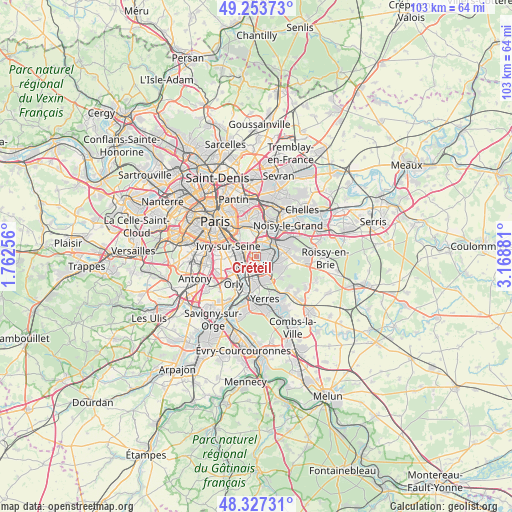
Créteil GPS coordinates[2]
48° 47' 33.576" North, 2° 27' 56.484" East
| Map corner | latitude | longitude |
|---|---|---|
| Upper-left | 49.25373°, | 1.76256° |
| Center: | 48.79266°, | 2.46569° |
| Lower-right: | 48.32731°, | 3.16881° |
| Map W x H: | 103×103 km | = 64×64mi |
| max Lat: | 51.07786° ⇑24.6% North |
| Créteil: | 48.79266° |
| min Lat: | ⇓75.4% South 41.3874° |
| min Long | Créteil | max Long |
| -5.08615° | 2.46569° | 9.52242° |
| W 50%⇐ | ⇒50% E |
Elevation
Elevation of Créteil is 35 m = 115 ft, and this is 158.7 m = 521 ft below average elevation for this country.
| Max E: |
2333 m = 7654 ft | 87.8% |
| Avg. | 193.7 m = 635 ft | |
| Créteil | 35 m = 115 ft | |
Min E: |
-1 m = -3 ft | 12.2% |
See also: Créteil elevation on elevation.city.
Geographical zone
Créteil is located in North temperate zone (between Tropic of Cancer and the Arctic Circle). Distance of this North polar circle is 1975.9 km =1227.8 mi to North.| Distance of | km | miles | from Créteil |
|---|---|---|---|
| North Pole | 4581.8 | 2847 | to North |
| Arctic Circle | 1975.9 | 1227.8 | to North |
| Tropic Cancer | 2819.3 | 1751.8 | to South |
| Equator | 5425.2 | 3371.1 | to South |


Nearby cities:
15 places around Créteil: (largest is in red/bold)
• Alfortville
3.6 km =2.2 mi,  293°
293°
• Bonneuil-sur-Marne
2.8 km =1.7 mi,  158°
158°
• Champigny-sur-Marne
3.3 km =2.1 mi,  37°
37°
• Charenton-le-Pont
5.1 km =3.2 mi,  309°
309°
• Chennevières-sur-Marne
5.5 km =3.4 mi,  84°
84°
• Choisy-le-Roi
4.4 km =2.7 mi,  231°
231°
• Joinville-le-Pont
3.7 km =2.3 mi,  10°
10°
• Limeil-Brévannes
5.5 km =3.4 mi, 163°
• Maisons-Alfort
2.9 km =1.8 mi,  317°
317°
• Nogent-sur-Marne
5 km =3.1 mi, 14°
• Saint-Maur-des-Fossés
2 km =1.2 mi,  85°
85°
• Saint-Maurice
4.3 km =2.7 mi, 318°
• Sucy-en-Brie
5.7 km =3.5 mi,  117°
117°
• Valenton
5.3 km =3.3 mi,  180°
180°
• Vitry-sur-Seine
4.6 km =2.9 mi,  262°
262°
Sources, notices
• [Note1] Compared only with cities in France existing in our database
• [Src1] Map data: © OpenStreetMap contributors (CC-BY-SA)
• [Src2] Other city data from geonames.org with taken over terms of usage.
• [Src3] Geographical zone / Annual Mean Temperature by Robert A. Rohde @ Wikipedia
