Chemiré-le-Gaudin geodata
Chemiré-le-Gaudin (Pays de la Loire) is a populated place; located in France in Europe/Paris (GMT+2) time zone. With population of 941 people, there are 9290 cities with bigger population in this country. Compared to other cities in France, 58.1% of cities are located further ↓South; 78.2% of cities are located further →East and 84.5% of cities have higher elevation than Chemiré-le-Gaudin. Note1
Administrative division(s):
- Level 1: Pays de la Loire
- Level 2: Sarthe
- Level 3: Arrondissement de La Flèche
- Level 4: Chemiré-le-Gaudin


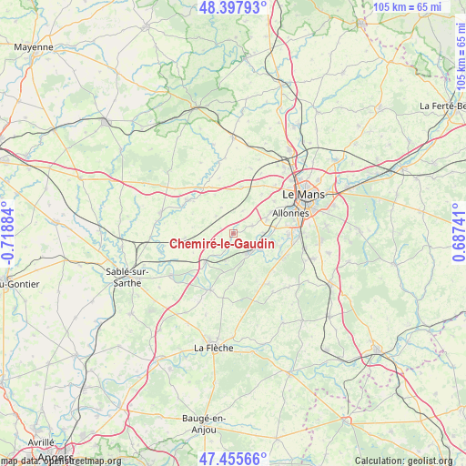
Chemiré-le-Gaudin GPS coordinates[2]
47° 55' 44.184" North, 0° 0' 56.592" West
| Map corner | latitude | longitude |
|---|---|---|
| Upper-left | 48.39793°, | -0.71884° |
| Center: | 47.92894°, | -0.01572° |
| Lower-right: | 47.45566°, | 0.68741° |
| Map W x H: | 104.8×104.8 km | = 65.1×65.1mi |
| max Lat: | 51.07786° ⇑41.9% North |
| Chemiré-le-Gaudin: | 47.92894° |
| min Lat: | ⇓58.1% South 41.3874° |
| min Long | Chemiré-le-Gau | max Long |
| -5.08615° | -0.01572° | 9.52242° |
| W 21.8%⇐ | ⇒78.2% E |
Elevation
Elevation of Chemiré-le-Gaudin is 43 m = 141 ft, and this is 150.7 m = 494 ft below average elevation for this country.
| Max E: |
2333 m = 7654 ft | 84.5% |
| Avg. | 193.7 m = 635 ft | |
| Chemiré-le-Gaudin | 43 m = 141 ft | |
Min E: |
-1 m = -3 ft | 15.5% |
See also: France elevation on elevation.city.
Geographical zone
Chemiré-le-Gaudin is located in North temperate zone (between Tropic of Cancer and the Arctic Circle). Distance of this North polar circle is 2072 km =1287.5 mi to North.| Distance of | km | miles | from Chemiré-le-Gaudin |
|---|---|---|---|
| North Pole | 4677.9 | 2906.7 | to North |
| Arctic Circle | 2072 | 1287.5 | to North |
| Tropic Cancer | 2723.3 | 1692.2 | to South |
| Equator | 5329.2 | 3311.4 | to South |


Nearby cities:
15 places around Chemiré-le-Gaudin: (largest is in red/bold)
• Chantenay-Villedieu
10.8 km =6.7 mi,  265°
265°
• Coulans-sur-Gée
10.4 km =6.5 mi,  10°
10°
• Fercé-sur-Sarthe
3.3 km =2.1 mi,  201°
201°
• Fillé
11 km =6.8 mi,  106°
106°
• La Suze-sur-Sarthe
5.5 km =3.4 mi,  146°
146°
• Louplande
3.5 km =2.2 mi,  312°
312°
• Mézeray
11.4 km =7.1 mi,  180°
180°
• Noyen-sur-Sarthe
8.9 km =5.5 mi,  224°
224°
• Roézé-sur-Sarthe
7.2 km =4.5 mi,  121°
121°
• Saint-Georges-du-Bois
10 km =6.2 mi,  60°
60°
• Saint-Jean-du-Bois
6.6 km =4.1 mi, 195°
• Souligné-Flacé
5.5 km =3.4 mi,  23°
23°
• Vallon-sur-Gée
5.5 km =3.4 mi, 314°
• Voivres-lès-le-Mans
6.5 km =4 mi,  89°
89°
• Étival-lès-le-Mans
7.7 km =4.8 mi,  72°
72°
Sources, notices
• [Note1] Compared only with cities in France existing in our database
• [Src1] Map data: © OpenStreetMap contributors (CC-BY-SA)
• [Src2] Other city data from geonames.org with taken over terms of usage.
• [Src3] Geographical zone / Annual Mean Temperature by Robert A. Rohde @ Wikipedia
