Voivres-lès-le-Mans geodata
Voivres-lès-le-Mans (Pays de la Loire) is a populated place; located in France in Europe/Paris (GMT+2) time zone. With population of 892 people, there are 9724 cities with bigger population in this country. Compared to other cities in France, 58.1% of cities are located further ↓South; 77.5% of cities are located further →East and 77.8% of cities have higher elevation than Voivres-lès-le-Mans. Note1
Administrative division(s):
- Level 1: Pays de la Loire
- Level 2: Sarthe
- Level 3: Arrondissement de La Flèche
- Level 4: Voivres-lès-le-Mans


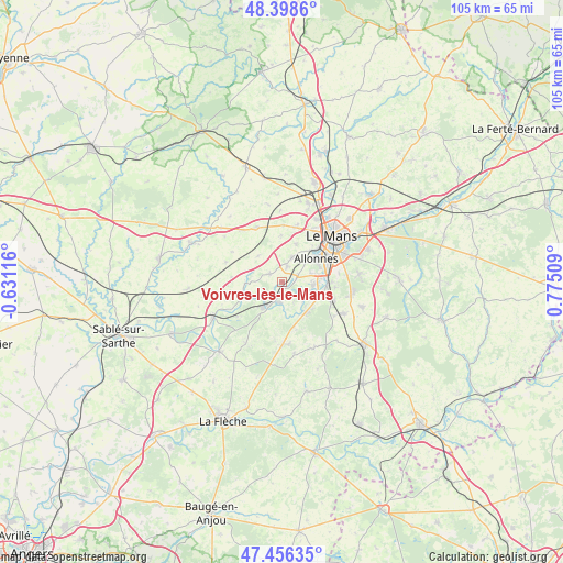
Voivres-lès-le-Mans GPS coordinates[2]
47° 55' 46.632" North, 0° 4' 19.092" East
| Map corner | latitude | longitude |
|---|---|---|
| Upper-left | 48.3986°, | -0.63116° |
| Center: | 47.92962°, | 0.07197° |
| Lower-right: | 47.45635°, | 0.77509° |
| Map W x H: | 104.8×104.8 km | = 65.1×65.1mi |
| max Lat: | 51.07786° ⇑41.9% North |
| Voivres-lès-le-Mans: | 47.92962° |
| min Lat: | ⇓58.1% South 41.3874° |
| min Long | Voivres-lès-le | max Long |
| -5.08615° | 0.07197° | 9.52242° |
| W 22.5%⇐ | ⇒77.5% E |
Elevation
Elevation of Voivres-lès-le-Mans is 60 m = 197 ft, and this is 133.7 m = 439 ft below average elevation for this country.
| Max E: |
2333 m = 7654 ft | 77.8% |
| Avg. | 193.7 m = 635 ft | |
| Voivres-lès-le-Mans | 60 m = 197 ft | |
Min E: |
-1 m = -3 ft | 22.2% |
See also: France elevation on elevation.city.
Geographical zone
Voivres-lès-le-Mans is located in North temperate zone (between Tropic of Cancer and the Arctic Circle). Distance of this North polar circle is 2071.9 km =1287.4 mi to North.| Distance of | km | miles | from Voivres-lès-le-Mans |
|---|---|---|---|
| North Pole | 4677.8 | 2906.6 | to North |
| Arctic Circle | 2071.9 | 1287.4 | to North |
| Tropic Cancer | 2723.4 | 1692.2 | to South |
| Equator | 5329.3 | 3311.5 | to South |


Nearby cities:
15 places around Voivres-lès-le-Mans: (largest is in red/bold)
• Allonnes
7.7 km =4.8 mi,  56°
56°
• Arnage
8.6 km =5.3 mi,  92°
92°
• Chemiré-le-Gaudin
6.5 km =4 mi,  269°
269°
• Fercé-sur-Sarthe
8.3 km =5.2 mi,  247°
247°
• Fillé
5.2 km =3.2 mi,  129°
129°
• Guécélard
7.2 km =4.5 mi,  143°
143°
• La Suze-sur-Sarthe
5.8 km =3.6 mi,  216°
216°
• Louplande
9.4 km =5.8 mi,  284°
284°
• Parigné-le-Pôlin
9.2 km =5.7 mi,  163°
163°
• Pruillé-le-Chétif
7.6 km =4.7 mi,  19°
19°
• Roézé-sur-Sarthe
3.8 km =2.4 mi,  185°
185°
• Saint-Georges-du-Bois
5.2 km =3.2 mi, 24°
• Souligné-Flacé
6.6 km =4.1 mi,  318°
318°
• Spay
6 km =3.7 mi,  96°
96°
• Étival-lès-le-Mans
2.4 km =1.5 mi, 20°
Sources, notices
• [Note1] Compared only with cities in France existing in our database
• [Src1] Map data: © OpenStreetMap contributors (CC-BY-SA)
• [Src2] Other city data from geonames.org with taken over terms of usage.
• [Src3] Geographical zone / Annual Mean Temperature by Robert A. Rohde @ Wikipedia
