Chauny geodata
Chauny (Hauts-de-France) is a populated place; located in France in Europe/Paris (GMT+2) time zone. With population of 13,176 people, there are 722 cities with bigger population in this country. Compared to other cities in France, 90.7% of cities are located further ↓South; 60.9% of cities are located further ←West and 82.2% of cities have higher elevation than Chauny. Note1
Administrative division(s):
- Level 1: Hauts-de-France
- Level 2: Département de l'Aisne
- Level 3: Arrondissement de Laon
- Level 4: Chauny


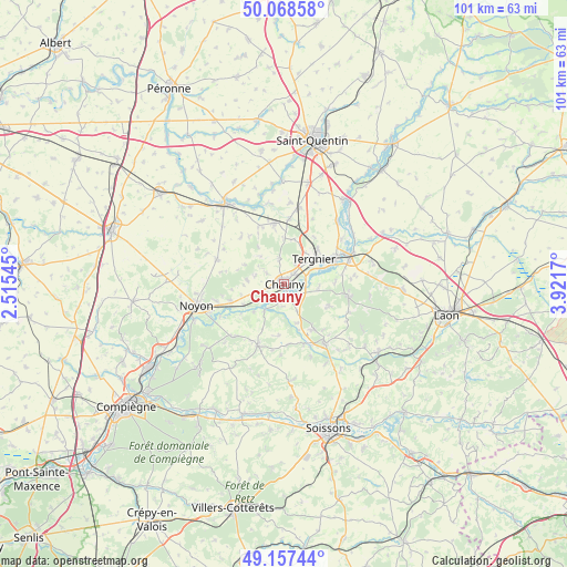
Chauny GPS coordinates[2]
49° 36' 54.504" North, 3° 13' 6.852" East
| Map corner | latitude | longitude |
|---|---|---|
| Upper-left | 50.06858°, | 2.51545° |
| Center: | 49.61514°, | 3.21857° |
| Lower-right: | 49.15744°, | 3.9217° |
| Map W x H: | 101.3×101.3 km | = 62.9×62.9mi |
| max Lat: | 51.07786° ⇑9.3% North |
| Chauny: | 49.61514° |
| min Lat: | ⇓90.7% South 41.3874° |
| min Long | Chauny | max Long |
| -5.08615° | 3.21857° | 9.52242° |
| W 60.9%⇐ | ⇒39.1% E |
Elevation
Elevation of Chauny is 49 m = 161 ft, and this is 144.7 m = 475 ft below average elevation for this country.
| Max E: |
2333 m = 7654 ft | 82.2% |
| Avg. | 193.7 m = 635 ft | |
| Chauny | 49 m = 161 ft | |
Min E: |
-1 m = -3 ft | 17.8% |
See also: France elevation on elevation.city.
Geographical zone
Chauny is located in North temperate zone (between Tropic of Cancer and the Arctic Circle). Distance of this North polar circle is 1884.5 km =1171 mi to North.| Distance of | km | miles | from Chauny |
|---|---|---|---|
| North Pole | 4490.4 | 2790.2 | to North |
| Arctic Circle | 1884.5 | 1171 | to North |
| Tropic Cancer | 2910.8 | 1808.7 | to South |
| Equator | 5516.7 | 3427.9 | to South |


Nearby cities:
15 places around Chauny: (largest is in red/bold)
• Amigny-Rouy
6.2 km =3.9 mi,  95°
95°
• Appilly
8.2 km =5.1 mi,  244°
244°
• Autreville
3.7 km =2.3 mi,  154°
154°
• Barisis
9 km =5.6 mi,  113°
113°
• Beautor
10 km =6.2 mi,  65°
65°
• Bichancourt
4 km =2.5 mi,  180°
180°
• Condren
4.8 km =3 mi, 70°
• Folembray
9.5 km =5.9 mi, 146°
• Frières-Faillouël
8.3 km =5.2 mi,  12°
12°
• Ognes
1.8 km =1.1 mi,  260°
260°
• Sinceny
2.9 km =1.8 mi,  136°
136°
• Tergnier
7.5 km =4.7 mi,  52°
52°
• Trosly-Loire
10.7 km =6.6 mi, 176°
• Villequier-Aumont
4.8 km =3 mi,  349°
349°
• Viry-Noureuil
2.6 km =1.6 mi,  43°
43°
Sources, notices
• [Note1] Compared only with cities in France existing in our database
• [Src1] Map data: © OpenStreetMap contributors (CC-BY-SA)
• [Src2] Other city data from geonames.org with taken over terms of usage.
• [Src3] Geographical zone / Annual Mean Temperature by Robert A. Rohde @ Wikipedia
