Autreville geodata
Autreville (Hauts-de-France) is a populated place; located in France in Europe/Paris (GMT+2) time zone. With population of 777 people, there are 10851 cities with bigger population in this country. Compared to other cities in France, 90.4% of cities are located further ↓South; 61.2% of cities are located further ←West and 75% of cities have higher elevation than Autreville. Note1
Administrative division(s):
- Level 1: Hauts-de-France
- Level 2: Département de l'Aisne
- Level 3: Arrondissement de Laon
- Level 4: Autreville


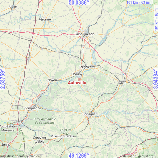
Autreville GPS coordinates[2]
49° 35' 5.568" North, 3° 14' 26.556" East
| Map corner | latitude | longitude |
|---|---|---|
| Upper-left | 50.0386°, | 2.53759° |
| Center: | 49.58488°, | 3.24071° |
| Lower-right: | 49.1269°, | 3.94384° |
| Map W x H: | 101.4×101.4 km | = 63×63mi |
| max Lat: | 51.07786° ⇑9.6% North |
| Autreville: | 49.58488° |
| min Lat: | ⇓90.4% South 41.3874° |
| min Long | Autreville | max Long |
| -5.08615° | 3.24071° | 9.52242° |
| W 61.2%⇐ | ⇒38.8% E |
Elevation
Elevation of Autreville is 67 m = 220 ft, and this is 126.7 m = 416 ft below average elevation for this country.
| Max E: |
2333 m = 7654 ft | 75% |
| Avg. | 193.7 m = 635 ft | |
| Autreville | 67 m = 220 ft | |
Min E: |
-1 m = -3 ft | 25% |
See also: France elevation on elevation.city.
Geographical zone
Autreville is located in North temperate zone (between Tropic of Cancer and the Arctic Circle). Distance of this North polar circle is 1887.9 km =1173.1 mi to North.| Distance of | km | miles | from Autreville |
|---|---|---|---|
| North Pole | 4493.7 | 2792.3 | to North |
| Arctic Circle | 1887.9 | 1173.1 | to North |
| Tropic Cancer | 2907.4 | 1806.6 | to South |
| Equator | 5513.3 | 3425.8 | to South |


Nearby cities:
15 places around Autreville: (largest is in red/bold)
• Amigny-Rouy
5.4 km =3.4 mi,  58°
58°
• Appilly
8.9 km =5.5 mi,  268°
268°
• Barisis
6.7 km =4.2 mi,  91°
91°
• Bichancourt
1.8 km =1.1 mi,  250°
250°
• Chauny
3.7 km =2.3 mi,  334°
334°
• Condren
5.7 km =3.5 mi,  30°
30°
• Coucy-le-Château-Auffrique
9.3 km =5.8 mi,  139°
139°
• Folembray
5.9 km =3.7 mi, 141°
• Ognes
4.6 km =2.9 mi,  311°
311°
• Saint-Gobain
9.9 km =6.2 mi,  83°
83°
• Sinceny
1.3 km =0.8 mi,  19°
19°
• Tergnier
9 km =5.6 mi, 28°
• Trosly-Loire
7.4 km =4.6 mi,  186°
186°
• Villequier-Aumont
8.5 km =5.3 mi,  343°
343°
• Viry-Noureuil
5.3 km =3.3 mi,  1°
1°
Sources, notices
• [Note1] Compared only with cities in France existing in our database
• [Src1] Map data: © OpenStreetMap contributors (CC-BY-SA)
• [Src2] Other city data from geonames.org with taken over terms of usage.
• [Src3] Geographical zone / Annual Mean Temperature by Robert A. Rohde @ Wikipedia
