Châteauponsac geodata
Châteauponsac (Nouvelle-Aquitaine) is a populated place; located in France in Europe/Paris (GMT+2) time zone. With population of 2,374 people, there are 4073 cities with bigger population in this country. Compared to other cities in France, 64.6% of cities are located further ↑North; 65.9% of cities are located further →East and 79.9% of cities have lower elevation than Châteauponsac. Note1
Administrative division(s):
- Level 1: Nouvelle-Aquitaine
- Level 2: Haute-Vienne
- Level 3: Arrondissement de Bellac
- Level 4: Châteauponsac


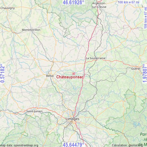
Châteauponsac GPS coordinates[2]
46° 8' 3.084" North, 1° 16' 29.82" East
| Map corner | latitude | longitude |
|---|---|---|
| Upper-left | 46.61928°, | 0.57182° |
| Center: | 46.13419°, | 1.27495° |
| Lower-right: | 45.64479°, | 1.97807° |
| Map W x H: | 108.4×108.4 km | = 67.4×67.4mi |
| max Lat: | 51.07786° ⇑64.6% North |
| Châteauponsac: | 46.13419° |
| min Lat: | ⇓35.4% South 41.3874° |
| min Long | Châteauponsac | max Long |
| -5.08615° | 1.27495° | 9.52242° |
| W 34.1%⇐ | ⇒65.9% E |
Elevation
Elevation of Châteauponsac is 289 m = 948 ft, and this is 95.3 m = 313 ft above average elevation for this country.
| Max E: |
2333 m = 7654 ft | 20.1% |
| Châteauponsac | 289 m 948 ft | |
| Avg. | 193.7 m = 635 ft | |
Min E: |
-1 m = -3 ft | 79.9% |
See also: France elevation on elevation.city.
Geographical zone
Châteauponsac is located in North temperate zone (between Tropic of Cancer and the Arctic Circle). Distance of this North polar circle is 2271.5 km =1411.4 mi to North.| Distance of | km | miles | from Châteauponsac |
|---|---|---|---|
| North Pole | 4877.4 | 3030.7 | to North |
| Arctic Circle | 2271.5 | 1411.4 | to North |
| Tropic Cancer | 2523.7 | 1568.2 | to South |
| Equator | 5129.6 | 3187.4 | to South |


Nearby cities:
15 places around Châteauponsac: (largest is in red/bold)
• Arnac-la-Poste
16.5 km =10.3 mi,  27°
27°
• Bersac-sur-Rivalier
13.1 km =8.1 mi,  116°
116°
• Bessines-sur-Gartempe
7.7 km =4.8 mi,  111°
111°
• Compreignac
15.8 km =9.8 mi,  180°
180°
• Folles
14.4 km =8.9 mi,  98°
98°
• Fromental
9.9 km =6.2 mi,  73°
73°
• Laurière
16.7 km =10.4 mi, 112°
• Magnac-Laval
12.3 km =7.6 mi,  317°
317°
• Nantiat
15.9 km =9.9 mi,  209°
209°
• Rancon
7.1 km =4.4 mi,  266°
266°
• Razès
12.4 km =7.7 mi,  154°
154°
• Saint-Léger-Magnazeix
17.2 km =10.7 mi,  352°
352°
• Saint-Maurice-la-Souterraine
14.9 km =9.3 mi,  53°
53°
• Saint-Sornin-Leulac
7.4 km =4.6 mi,  13°
13°
• Saint-Sylvestre
17.3 km =10.7 mi, 152°
Sources, notices
• [Note1] Compared only with cities in France existing in our database
• [Src1] Map data: © OpenStreetMap contributors (CC-BY-SA)
• [Src2] Other city data from geonames.org with taken over terms of usage.
• [Src3] Geographical zone / Annual Mean Temperature by Robert A. Rohde @ Wikipedia
