Châteauneuf-sur-Sarthe geodata
Châteauneuf-sur-Sarthe (Pays de la Loire) is a populated place; located in France in Europe/Paris (GMT+2) time zone. With population of 2,651 people, there are 3673 cities with bigger population in this country. Compared to other cities in France, 53.9% of cities are located further ↓South; 83.2% of cities are located further →East and 88.6% of cities have higher elevation than Châteauneuf-sur-Sarthe. Note1
Administrative division(s):
- Level 1: Pays de la Loire
- Level 2: Département de Maine-et-Loire
- Level 3: Arrondissement de Segré
- Level 4: Les Hauts-d'Anjou
Current local time in Châteauneuf-sur-Sarthe:
06:51 PM, SaturdayDifference from your time zone: hours


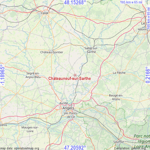
Châteauneuf-sur-Sarthe GPS coordinates[2]
47° 40' 53.22" North, 0° 29' 11.472" West
| Map corner | latitude | longitude |
|---|---|---|
| Upper-left | 48.15268°, | -1.18965° |
| Center: | 47.68145°, | -0.48652° |
| Lower-right: | 47.20592°, | 0.2166° |
| Map W x H: | 105.3×105.3 km | = 65.4×65.4mi |
| max Lat: | 51.07786° ⇑46.1% North |
| Châteauneuf-sur-Sarthe: | 47.68145° |
| min Lat: | ⇓53.9% South 41.3874° |
| min Long | Châteauneuf-su | max Long |
| -5.08615° | -0.48652° | 9.52242° |
| W 16.8%⇐ | ⇒83.2% E |
Elevation
Elevation of Châteauneuf-sur-Sarthe is 33 m = 108 ft, and this is 160.7 m = 527 ft below average elevation for this country.
| Max E: |
2333 m = 7654 ft | 88.6% |
| Avg. | 193.7 m = 635 ft | |
| Châteauneuf-sur-Sarthe | 33 m = 108 ft | |
Min E: |
-1 m = -3 ft | 11.4% |
See also: France elevation on elevation.city.
Geographical zone
Châteauneuf-sur-Sarthe is located in North temperate zone (between Tropic of Cancer and the Arctic Circle). Distance of this North polar circle is 2099.5 km =1304.6 mi to North.| Distance of | km | miles | from Châteauneuf-sur-Sarthe |
|---|---|---|---|
| North Pole | 4705.4 | 2923.8 | to North |
| Arctic Circle | 2099.5 | 1304.6 | to North |
| Tropic Cancer | 2695.8 | 1675.1 | to South |
| Equator | 5301.7 | 3294.3 | to South |


Nearby cities:
15 places around Châteauneuf-sur-Sarthe: (largest is in red/bold)
• Briollay
13.1 km =8.1 mi,  186°
186°
• Brissarthe
3.5 km =2.2 mi,  53°
53°
• Champigné
6.7 km =4.2 mi,  252°
252°
• Cheffes
7.3 km =4.5 mi, 187°
• Contigné
5.8 km =3.6 mi,  336°
336°
• Daumeray
9.6 km =6 mi,  77°
77°
• Juigné
8.1 km =5 mi,  59°
59°
• Juvardeil
3.1 km =1.9 mi,  195°
195°
• Marigné
10.9 km =6.8 mi,  295°
295°
• Miré
8.5 km =5.3 mi,  357°
357°
• Morannes
8.7 km =5.4 mi,  37°
37°
• Soucelles
13.6 km =8.5 mi,  157°
157°
• Soulaire-et-Bourg
12.4 km =7.7 mi, 203°
• Tiercé
7.5 km =4.7 mi,  168°
168°
• Étriché
4.7 km =2.9 mi,  136°
136°
Sources, notices
• [Note1] Compared only with cities in France existing in our database
• [Src1] Map data: © OpenStreetMap contributors (CC-BY-SA)
• [Src2] Other city data from geonames.org with taken over terms of usage.
• [Src3] Geographical zone / Annual Mean Temperature by Robert A. Rohde @ Wikipedia
