Chasseneuil geodata
Chasseneuil (Centre) is a populated place; located in France in Europe/Paris (GMT+2) time zone. With population of 620 people, there are 12983 cities with bigger population in this country. Compared to other cities in France, 58.8% of cities are located further ↑North; 63.1% of cities are located further →East and 55.9% of cities have lower elevation than Chasseneuil. Note1
Administrative division(s):
- Level 1: Centre
- Level 2: Département de l'Indre
- Level 3: Arrondissement de Châteauroux
- Level 4: Chasseneuil


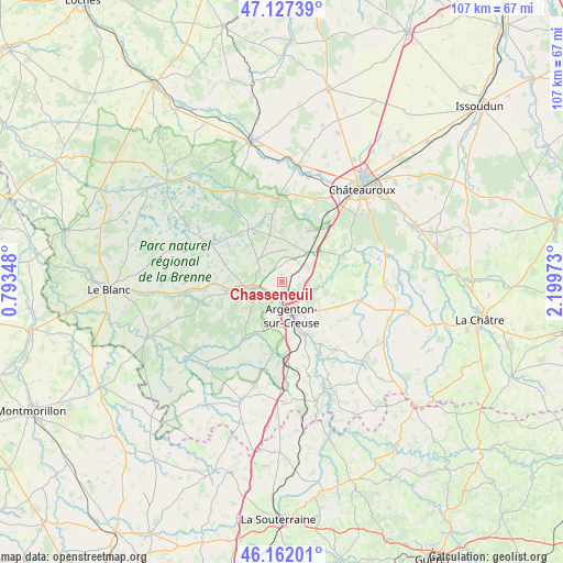
Chasseneuil GPS coordinates[2]
46° 38' 48.66" North, 1° 29' 47.76" East
| Map corner | latitude | longitude |
|---|---|---|
| Upper-left | 47.12739°, | 0.79348° |
| Center: | 46.64685°, | 1.4966° |
| Lower-right: | 46.16201°, | 2.19973° |
| Map W x H: | 107.3×107.3 km | = 66.7×66.7mi |
| max Lat: | 51.07786° ⇑58.8% North |
| Chasseneuil: | 46.64685° |
| min Lat: | ⇓41.2% South 41.3874° |
| min Long | Chasseneuil | max Long |
| -5.08615° | 1.4966° | 9.52242° |
| W 36.9%⇐ | ⇒63.1% E |
Elevation
Elevation of Chasseneuil is 153 m = 502 ft, and this is 40.7 m = 134 ft below average elevation for this country.
| Max E: |
2333 m = 7654 ft | 44.1% |
| Avg. | 193.7 m = 635 ft | |
| Chasseneuil | 153 m = 502 ft | |
Min E: |
-1 m = -3 ft | 55.9% |
See also: France elevation on elevation.city.
Geographical zone
Chasseneuil is located in North temperate zone (between Tropic of Cancer and the Arctic Circle). Distance of this North polar circle is 2214.5 km =1376 mi to North.| Distance of | km | miles | from Chasseneuil |
|---|---|---|---|
| North Pole | 4820.4 | 2995.3 | to North |
| Arctic Circle | 2214.5 | 1376 | to North |
| Tropic Cancer | 2580.7 | 1603.6 | to South |
| Equator | 5186.6 | 3222.8 | to South |


Nearby cities:
15 places around Chasseneuil: (largest is in red/bold)
• Argenton-sur-Creuse
6.6 km =4.1 mi,  164°
164°
• Arthon
16.3 km =10.1 mi,  71°
71°
• Badecon-le-Pin
14 km =8.7 mi,  147°
147°
• Ceaulmont
15 km =9.3 mi, 156°
• Chabenet
2.5 km =1.6 mi,  177°
177°
• Ciron
19.3 km =12 mi,  263°
263°
• Le Pêchereau
8.7 km =5.4 mi, 153°
• Luant
10.7 km =6.6 mi,  26°
26°
• Neuillay-les-Bois
13.3 km =8.3 mi,  353°
353°
• Rivarennes
8.5 km =5.3 mi, 261°
• Saint-Gaultier
6.5 km =4 mi, 258°
• Saint-Marcel
5.2 km =3.2 mi,  165°
165°
• Thenay
5.6 km =3.5 mi,  251°
251°
• Velles
12.6 km =7.8 mi, 68°
• Vendœuvres
20.4 km =12.7 mi,  326°
326°
Sources, notices
• [Note1] Compared only with cities in France existing in our database
• [Src1] Map data: © OpenStreetMap contributors (CC-BY-SA)
• [Src2] Other city data from geonames.org with taken over terms of usage.
• [Src3] Geographical zone / Annual Mean Temperature by Robert A. Rohde @ Wikipedia
