Velles geodata
Velles (Centre) is a populated place; located in France in Europe/Paris (GMT+2) time zone. With population of 832 people, there are 10268 cities with bigger population in this country. Compared to other cities in France, 58.3% of cities are located further ↑North; 61% of cities are located further →East and 52.2% of cities have lower elevation than Velles. Note1
Administrative division(s):
- Level 1: Centre
- Level 2: Département de l'Indre
- Level 3: Arrondissement de Châteauroux
- Level 4: Velles


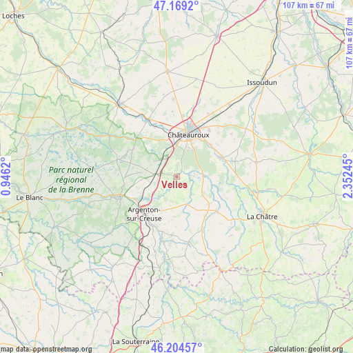
Velles GPS coordinates[2]
46° 41' 20.544" North, 1° 38' 57.588" East
| Map corner | latitude | longitude |
|---|---|---|
| Upper-left | 47.1692°, | 0.9462° |
| Center: | 46.68904°, | 1.64933° |
| Lower-right: | 46.20457°, | 2.35245° |
| Map W x H: | 107.3×107.3 km | = 66.7×66.7mi |
| max Lat: | 51.07786° ⇑58.3% North |
| Velles: | 46.68904° |
| min Lat: | ⇓41.7% South 41.3874° |
| min Long | Velles | max Long |
| -5.08615° | 1.64933° | 9.52242° |
| W 39%⇐ | ⇒61% E |
Elevation
Elevation of Velles is 140 m = 459 ft, and this is 53.7 m = 176 ft below average elevation for this country.
| Max E: |
2333 m = 7654 ft | 47.8% |
| Avg. | 193.7 m = 635 ft | |
| Velles | 140 m = 459 ft | |
Min E: |
-1 m = -3 ft | 52.2% |
See also: France elevation on elevation.city.
Geographical zone
Velles is located in North temperate zone (between Tropic of Cancer and the Arctic Circle). Distance of this North polar circle is 2209.8 km =1373.1 mi to North.| Distance of | km | miles | from Velles |
|---|---|---|---|
| North Pole | 4815.7 | 2992.3 | to North |
| Arctic Circle | 2209.8 | 1373.1 | to North |
| Tropic Cancer | 2585.4 | 1606.5 | to South |
| Equator | 5191.3 | 3225.7 | to South |


Nearby cities:
15 places around Velles: (largest is in red/bold)
• Ardentes
15.3 km =9.5 mi,  67°
67°
• Argenton-sur-Creuse
14.8 km =9.2 mi,  221°
221°
• Arthon
3.8 km =2.4 mi,  82°
82°
• Chabenet
13.6 km =8.5 mi,  238°
238°
• Chasseneuil
12.6 km =7.8 mi,  248°
248°
• Châteauroux
14.1 km =8.8 mi,  13°
13°
• Déols
16.2 km =10.1 mi,  15°
15°
• Le Poinçonnet
9.8 km =6.1 mi,  32°
32°
• Le Pêchereau
14.7 km =9.1 mi,  211°
211°
• Luant
8.5 km =5.3 mi,  305°
305°
• Neuillay-les-Bois
15.7 km =9.8 mi,  302°
302°
• Neuvy-Saint-Sépulchre
15.7 km =9.8 mi,  130°
130°
• Saint-Marcel
14.2 km =8.8 mi,  227°
227°
• Saint-Maur
13.1 km =8.1 mi,  356°
356°
• Étrechet
14.4 km =8.9 mi,  45°
45°
Sources, notices
• [Note1] Compared only with cities in France existing in our database
• [Src1] Map data: © OpenStreetMap contributors (CC-BY-SA)
• [Src2] Other city data from geonames.org with taken over terms of usage.
• [Src3] Geographical zone / Annual Mean Temperature by Robert A. Rohde @ Wikipedia
