Vendœuvres geodata
Vendœuvres (Centre) is a populated place; located in France in Europe/Paris (GMT+2) time zone. With population of 1,018 people, there are 8707 cities with bigger population in this country. Compared to other cities in France, 57.2% of cities are located further ↑North; 65% of cities are located further →East and 54.4% of cities have higher elevation than Vendœuvres. Note1
Administrative division(s):
- Level 1: Centre
- Level 2: Département de l'Indre
- Level 3: Arrondissement de Châteauroux
- Level 4: Vendœuvres


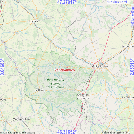
Vendœuvres GPS coordinates[2]
46° 48' 0" North, 1° 21' 0" East
| Map corner | latitude | longitude |
|---|---|---|
| Upper-left | 47.27917°, | 0.64688° |
| Center: | 46.8°, | 1.35° |
| Lower-right: | 46.31652°, | 2.05313° |
| Map W x H: | 107×107 km | = 66.5×66.5mi |
| max Lat: | 51.07786° ⇑57.2% North |
| Vendœuvres: | 46.8° |
| min Lat: | ⇓42.8% South 41.3874° |
| min Long | Vendœuvres | max Long |
| -5.08615° | 1.35° | 9.52242° |
| W 35%⇐ | ⇒65% E |
Elevation
Elevation of Vendœuvres is 118 m = 387 ft, and this is 75.7 m = 248 ft below average elevation for this country.
| Max E: |
2333 m = 7654 ft | 54.4% |
| Avg. | 193.7 m = 635 ft | |
| Vendœuvres | 118 m = 387 ft | |
Min E: |
-1 m = -3 ft | 45.6% |
See also: France elevation on elevation.city.
Geographical zone
Vendœuvres is located in North temperate zone (between Tropic of Cancer and the Arctic Circle). Distance of this North polar circle is 2197.5 km =1365.5 mi to North.| Distance of | km | miles | from Vendœuvres |
|---|---|---|---|
| North Pole | 4803.4 | 2984.7 | to North |
| Arctic Circle | 2197.5 | 1365.5 | to North |
| Tropic Cancer | 2597.8 | 1614.2 | to South |
| Equator | 5203.7 | 3233.4 | to South |


Nearby cities:
15 places around Vendœuvres: (largest is in red/bold)
• Argy
17 km =10.6 mi,  23°
23°
• Buzançais
11.2 km =7 mi,  28°
28°
• Chasseneuil
20.4 km =12.7 mi,  146°
146°
• Clion
18 km =11.2 mi,  330°
330°
• Luant
17.5 km =10.9 mi,  115°
115°
• Mézières-en-Brenne
10.8 km =6.7 mi,  281°
281°
• Neuillay-les-Bois
10.3 km =6.4 mi,  111°
111°
• Niherne
16.6 km =10.3 mi,  79°
79°
• Palluau-sur-Indre
16.1 km =10 mi,  349°
349°
• Rivarennes
18.5 km =11.5 mi,  171°
171°
• Rosnay
15.1 km =9.4 mi,  223°
223°
• Saint-Gaultier
18.9 km =11.7 mi, 165°
• Saint-Genou
14.4 km =8.9 mi,  356°
356°
• Thenay
19.7 km =12.2 mi,  162°
162°
• Villedieu-sur-Indre
15.3 km =9.5 mi,  70°
70°
Sources, notices
• [Note1] Compared only with cities in France existing in our database
• [Src1] Map data: © OpenStreetMap contributors (CC-BY-SA)
• [Src2] Other city data from geonames.org with taken over terms of usage.
• [Src3] Geographical zone / Annual Mean Temperature by Robert A. Rohde @ Wikipedia
