Charmont-sous-Barbuise geodata
Charmont-sous-Barbuise (Grand Est) is a populated place; located in France in Europe/Paris (GMT+2) time zone. With population of 696 people, there are 11855 cities with bigger population in this country. Compared to other cities in France, 66.5% of cities are located further ↓South; 69.5% of cities are located further ←West and 50.5% of cities have higher elevation than Charmont-sous-Barbuise. Note1
Administrative division(s):
- Level 1: Grand Est
- Level 2: Département de l'Aube
- Level 3: Arrondissement de Troyes
- Level 4: Charmont-sous-Barbuise
Current local time in Charmont-sous-Barbuise:
04:36 AM, SaturdayDifference from your time zone: hours


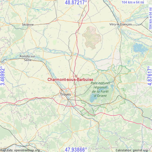
Charmont-sous-Barbuise GPS coordinates[2]
48° 24' 27.216" North, 4° 10' 22.98" East
| Map corner | latitude | longitude |
|---|---|---|
| Upper-left | 48.87217°, | 3.46992° |
| Center: | 48.40756°, | 4.17305° |
| Lower-right: | 47.93866°, | 4.87617° |
| Map W x H: | 103.8×103.8 km | = 64.5×64.5mi |
| max Lat: | 51.07786° ⇑33.5% North |
| Charmont-sous-Barbuise: | 48.40756° |
| min Lat: | ⇓66.5% South 41.3874° |
| min Long | Charmont-sous-B | max Long |
| -5.08615° | 4.17305° | 9.52242° |
| W 69.5%⇐ | ⇒30.5% E |
Elevation
Elevation of Charmont-sous-Barbuise is 130 m = 427 ft, and this is 63.7 m = 209 ft below average elevation for this country.
| Max E: |
2333 m = 7654 ft | 50.5% |
| Avg. | 193.7 m = 635 ft | |
| Charmont-sous-Barbuise | 130 m = 427 ft | |
Min E: |
-1 m = -3 ft | 49.5% |
See also: France elevation on elevation.city.
Geographical zone
Charmont-sous-Barbuise is located in North temperate zone (between Tropic of Cancer and the Arctic Circle). Distance of this North polar circle is 2018.8 km =1254.4 mi to North.| Distance of | km | miles | from Charmont-sous-Barbuise |
|---|---|---|---|
| North Pole | 4624.6 | 2873.6 | to North |
| Arctic Circle | 2018.8 | 1254.4 | to North |
| Tropic Cancer | 2776.5 | 1725.2 | to South |
| Equator | 5382.4 | 3344.5 | to South |


Nearby cities:
15 places around Charmont-sous-Barbuise: (largest is in red/bold)
• Arcis-sur-Aube
14.2 km =8.8 mi,  350°
350°
• Barberey-Saint-Sulpice
12.9 km =8 mi,  233°
233°
• Creney-près-Troyes
8.8 km =5.5 mi,  199°
199°
• La Chapelle-Saint-Luc
14.1 km =8.8 mi,  224°
224°
• Les Noës-près-Troyes
14.9 km =9.3 mi, 219°
• Mergey
12.4 km =7.7 mi,  258°
258°
• Payns
14.7 km =9.1 mi, 259°
• Piney
12.8 km =8 mi,  112°
112°
• Pont-Sainte-Marie
11.5 km =7.1 mi,  210°
210°
• Saint-Lyé
13.7 km =8.5 mi,  249°
249°
• Saint-Parres-aux-Tertres
12.9 km =8 mi, 198°
• Sainte-Maure
10.7 km =6.6 mi, 231°
• Sainte-Savine
15.5 km =9.6 mi, 217°
• Troyes
13.5 km =8.4 mi, 208°
• Villechétif
10.9 km =6.8 mi,  191°
191°
Sources, notices
• [Note1] Compared only with cities in France existing in our database
• [Src1] Map data: © OpenStreetMap contributors (CC-BY-SA)
• [Src2] Other city data from geonames.org with taken over terms of usage.
• [Src3] Geographical zone / Annual Mean Temperature by Robert A. Rohde @ Wikipedia
