Arcis-sur-Aube geodata
Arcis-sur-Aube (Grand Est) is a populated place; located in France in Europe/Paris (GMT+2) time zone. With population of 2,948 people, there are 3305 cities with bigger population in this country. Compared to other cities in France, 69.2% of cities are located further ↓South; 69.2% of cities are located further ←West and 62% of cities have higher elevation than Arcis-sur-Aube. Note1
Administrative division(s):
- Level 1: Grand Est
- Level 2: Département de l'Aube
- Level 3: Arrondissement de Troyes
- Level 4: Arcis-sur-Aube


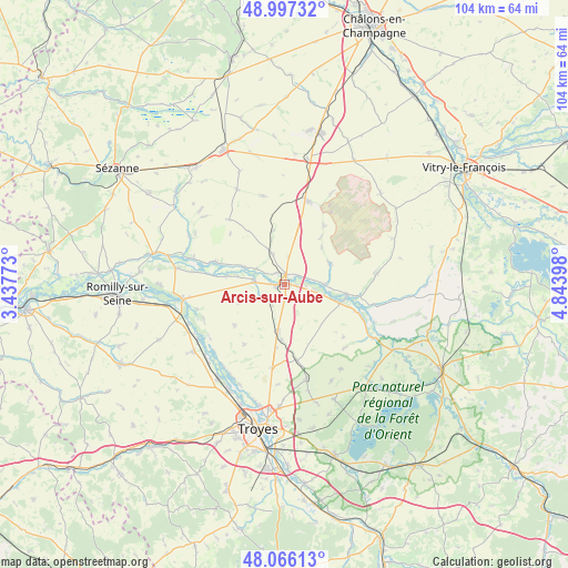
Arcis-sur-Aube GPS coordinates[2]
48° 32' 1.932" North, 4° 8' 27.06" East
| Map corner | latitude | longitude |
|---|---|---|
| Upper-left | 48.99732°, | 3.43773° |
| Center: | 48.53387°, | 4.14085° |
| Lower-right: | 48.06613°, | 4.84398° |
| Map W x H: | 103.5×103.5 km | = 64.3×64.3mi |
| max Lat: | 51.07786° ⇑30.8% North |
| Arcis-sur-Aube: | 48.53387° |
| min Lat: | ⇓69.2% South 41.3874° |
| min Long | Arcis-sur-Aube | max Long |
| -5.08615° | 4.14085° | 9.52242° |
| W 69.2%⇐ | ⇒30.8% E |
Elevation
Elevation of Arcis-sur-Aube is 97 m = 318 ft, and this is 96.7 m = 317 ft below average elevation for this country.
| Max E: |
2333 m = 7654 ft | 62% |
| Avg. | 193.7 m = 635 ft | |
| Arcis-sur-Aube | 97 m = 318 ft | |
Min E: |
-1 m = -3 ft | 38% |
See also: France elevation on elevation.city.
Geographical zone
Arcis-sur-Aube is located in North temperate zone (between Tropic of Cancer and the Arctic Circle). Distance of this North polar circle is 2004.7 km =1245.7 mi to North.| Distance of | km | miles | from Arcis-sur-Aube |
|---|---|---|---|
| North Pole | 4610.6 | 2864.9 | to North |
| Arctic Circle | 2004.7 | 1245.7 | to North |
| Tropic Cancer | 2790.5 | 1733.9 | to South |
| Equator | 5396.5 | 3353.2 | to South |


Nearby cities:
15 places around Arcis-sur-Aube: (largest is in red/bold)
• Barberey-Saint-Sulpice
23.1 km =14.4 mi,  200°
200°
• Charmont-sous-Barbuise
14.2 km =8.8 mi,  170°
170°
• Châtres
21.9 km =13.6 mi,  260°
260°
• Clesles
22.7 km =14.1 mi,  269°
269°
• Creney-près-Troyes
22.3 km =13.9 mi,  181°
181°
• Fontaine-les-Grès
22 km =13.7 mi,  233°
233°
• Mailly-le-Camp
15.5 km =9.6 mi,  19°
19°
• Mergey
19.2 km =11.9 mi,  210°
210°
• Méry-sur-Seine
18.6 km =11.6 mi, 261°
• Payns
20.7 km =12.9 mi,  215°
215°
• Plancy-l'Abbaye
13.3 km =8.3 mi,  285°
285°
• Saint-Lyé
21.5 km =13.4 mi, 209°
• Saint-Mesmin
18.9 km =11.7 mi,  237°
237°
• Sainte-Maure
21.6 km =13.4 mi, 196°
• Savières
19.8 km =12.3 mi, 225°
Sources, notices
• [Note1] Compared only with cities in France existing in our database
• [Src1] Map data: © OpenStreetMap contributors (CC-BY-SA)
• [Src2] Other city data from geonames.org with taken over terms of usage.
• [Src3] Geographical zone / Annual Mean Temperature by Robert A. Rohde @ Wikipedia
