Chalonnes-sur-Loire geodata
Chalonnes-sur-Loire (Pays de la Loire) is a populated place; located in France in Europe/Paris (GMT+2) time zone. With population of 5,950 people, there are 1660 cities with bigger population in this country. Compared to other cities in France, 50.7% of cities are located further ↑North; 86.1% of cities are located further →East and 92% of cities have higher elevation than Chalonnes-sur-Loire. Note1
Administrative division(s):
- Level 1: Pays de la Loire
- Level 2: Département de Maine-et-Loire
- Level 3: Angers
- Level 4: Chalonnes-sur-Loire


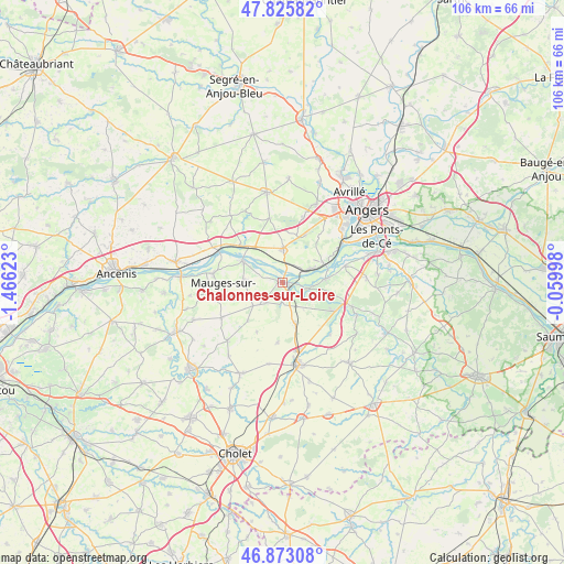
Chalonnes-sur-Loire GPS coordinates[2]
47° 21' 5.76" North, 0° 45' 47.16" West
| Map corner | latitude | longitude |
|---|---|---|
| Upper-left | 47.82582°, | -1.46623° |
| Center: | 47.3516°, | -0.7631° |
| Lower-right: | 46.87308°, | -0.05998° |
| Map W x H: | 105.9×105.9 km | = 65.8×65.8mi |
| max Lat: | 51.07786° ⇑50.7% North |
| Chalonnes-sur-Loire: | 47.3516° |
| min Lat: | ⇓49.3% South 41.3874° |
| min Long | Chalonnes-sur-L | max Long |
| -5.08615° | -0.7631° | 9.52242° |
| W 13.9%⇐ | ⇒86.1% E |
Elevation
Elevation of Chalonnes-sur-Loire is 25 m = 82 ft, and this is 168.7 m = 553 ft below average elevation for this country.
| Max E: |
2333 m = 7654 ft | 92% |
| Avg. | 193.7 m = 635 ft | |
| Chalonnes-sur-Loire | 25 m = 82 ft | |
Min E: |
-1 m = -3 ft | 8% |
See also: France elevation on elevation.city.
Geographical zone
Chalonnes-sur-Loire is located in North temperate zone (between Tropic of Cancer and the Arctic Circle). Distance of this North polar circle is 2136.2 km =1327.4 mi to North.| Distance of | km | miles | from Chalonnes-sur-Loire |
|---|---|---|---|
| North Pole | 4742.1 | 2946.6 | to North |
| Arctic Circle | 2136.2 | 1327.4 | to North |
| Tropic Cancer | 2659.1 | 1652.3 | to South |
| Equator | 5265 | 3271.5 | to South |


Nearby cities:
15 places around Chalonnes-sur-Loire: (largest is in red/bold)
• Bourgneuf-en-Mauges
7 km =4.3 mi,  231°
231°
• Champtocé-sur-Loire
10.2 km =6.3 mi,  311°
311°
• Chaudefonds-sur-Layon
5.2 km =3.2 mi,  124°
124°
• La Jumellière
8.4 km =5.2 mi,  162°
162°
• La Pommeraye
7.2 km =4.5 mi,  273°
273°
• La Possonnière
6.4 km =4 mi,  66°
66°
• Montjean-sur-Loire
8.3 km =5.2 mi,  299°
299°
• Rochefort-sur-Loire
8 km =5 mi,  85°
85°
• Saint-Aubin-de-Luigné
7.9 km =4.9 mi,  110°
110°
• Saint-Georges-sur-Loire
6.3 km =3.9 mi,  0°
0°
• Saint-Germain-des-Prés
8.4 km =5.2 mi,  320°
320°
• Saint-Laurent-de-la-Plaine
4.9 km =3 mi,  218°
218°
• Saint-Martin-du-Fouilloux
10.2 km =6.3 mi,  26°
26°
• Sainte-Christine
9.7 km =6 mi, 221°
• Savennières
8.7 km =5.4 mi, 66°
Sources, notices
• [Note1] Compared only with cities in France existing in our database
• [Src1] Map data: © OpenStreetMap contributors (CC-BY-SA)
• [Src2] Other city data from geonames.org with taken over terms of usage.
• [Src3] Geographical zone / Annual Mean Temperature by Robert A. Rohde @ Wikipedia
