Saint-Laurent-de-la-Plaine geodata
Saint-Laurent-de-la-Plaine (Pays de la Loire) is a populated place; located in France in Europe/Paris (GMT+2) time zone. With population of 1,633 people, there are 5722 cities with bigger population in this country. Compared to other cities in France, 51.3% of cities are located further ↑North; 86.5% of cities are located further →East and 69.7% of cities have higher elevation than Saint-Laurent-de-la-Plaine. Note1
Administrative division(s):
- Level 1: Pays de la Loire
- Level 2: Département de Maine-et-Loire
- Level 3: Arrondissement de Cholet
- Level 4: Mauges-sur-Loire
Current local time in Saint-Laurent-de-la-Plaine:
11:29 AM, SaturdayDifference from your time zone: hours


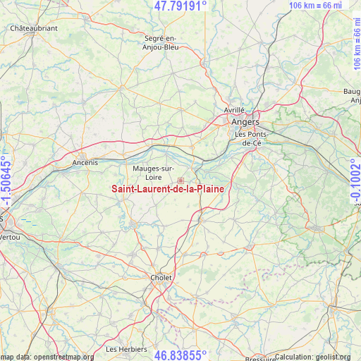
Saint-Laurent-de-la-Plaine GPS coordinates[2]
47° 19' 2.568" North, 0° 48' 11.988" West
| Map corner | latitude | longitude |
|---|---|---|
| Upper-left | 47.79191°, | -1.50645° |
| Center: | 47.31738°, | -0.80333° |
| Lower-right: | 46.83855°, | -0.1002° |
| Map W x H: | 106×106 km | = 65.9×65.9mi |
| max Lat: | 51.07786° ⇑51.3% North |
| Saint-Laurent-de-la-Plaine: | 47.31738° |
| min Lat: | ⇓48.7% South 41.3874° |
| min Long | Saint-Laurent-d | max Long |
| -5.08615° | -0.80333° | 9.52242° |
| W 13.5%⇐ | ⇒86.5% E |
Elevation
Elevation of Saint-Laurent-de-la-Plaine is 79 m = 259 ft, and this is 114.7 m = 376 ft below average elevation for this country.
| Max E: |
2333 m = 7654 ft | 69.7% |
| Avg. | 193.7 m = 635 ft | |
| Saint-Laurent-de-la-Plaine | 79 m = 259 ft | |
Min E: |
-1 m = -3 ft | 30.3% |
See also: France elevation on elevation.city.
Geographical zone
Saint-Laurent-de-la-Plaine is located in North temperate zone (between Tropic of Cancer and the Arctic Circle). Distance of this North polar circle is 2140 km =1329.7 mi to North.| Distance of | km | miles | from Saint-Laurent-de-la-Plaine |
|---|---|---|---|
| North Pole | 4745.9 | 2949 | to North |
| Arctic Circle | 2140 | 1329.7 | to North |
| Tropic Cancer | 2655.3 | 1649.9 | to South |
| Equator | 5261.2 | 3269.2 | to South |


Nearby cities:
15 places around Saint-Laurent-de-la-Plaine: (largest is in red/bold)
• Bourgneuf-en-Mauges
2.5 km =1.6 mi,  257°
257°
• Chalonnes-sur-Loire
4.9 km =3 mi,  38°
38°
• Chaudefonds-sur-Layon
7.4 km =4.6 mi,  82°
82°
• La Jumellière
7 km =4.3 mi,  126°
126°
• La Pommeraye
6 km =3.7 mi,  315°
315°
• La Possonnière
10.9 km =6.8 mi,  54°
54°
• Le Pin-en-Mauges
10.1 km =6.3 mi,  225°
225°
• Montjean-sur-Loire
8.9 km =5.5 mi,  332°
332°
• Neuvy-en-Mauges
5.8 km =3.6 mi,  196°
196°
• Saint-Aubin-de-Luigné
10.5 km =6.5 mi, 84°
• Saint-Georges-sur-Loire
10.5 km =6.5 mi,  17°
17°
• Saint-Germain-des-Prés
10.5 km =6.5 mi,  347°
347°
• Saint-Lézin
7.8 km =4.8 mi,  163°
163°
• Saint-Quentin-en-Mauges
8.7 km =5.4 mi,  250°
250°
• Sainte-Christine
4.8 km =3 mi,  224°
224°
Sources, notices
• [Note1] Compared only with cities in France existing in our database
• [Src1] Map data: © OpenStreetMap contributors (CC-BY-SA)
• [Src2] Other city data from geonames.org with taken over terms of usage.
• [Src3] Geographical zone / Annual Mean Temperature by Robert A. Rohde @ Wikipedia
