Sainte-Christine geodata
Sainte-Christine (Pays de la Loire) is a populated place; located in France in Europe/Paris (GMT+2) time zone. With population of 627 people, there are 12867 cities with bigger population in this country. Compared to other cities in France, 51.7% of cities are located further ↑North; 86.9% of cities are located further →East and 59.4% of cities have higher elevation than Sainte-Christine. Note1
Administrative division(s):
- Level 1: Pays de la Loire
- Level 2: Département de Maine-et-Loire
- Level 3: Arrondissement de Cholet
- Level 4: Chemillé-en-Anjou


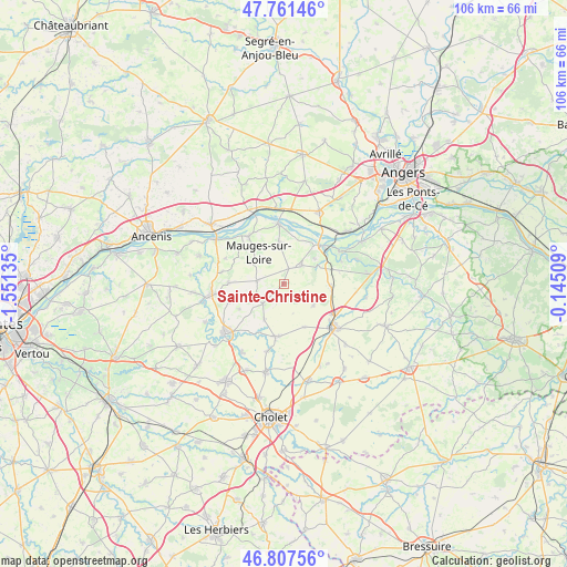
Sainte-Christine GPS coordinates[2]
47° 17' 11.976" North, 0° 50' 53.592" West
| Map corner | latitude | longitude |
|---|---|---|
| Upper-left | 47.76146°, | -1.55135° |
| Center: | 47.28666°, | -0.84822° |
| Lower-right: | 46.80756°, | -0.14509° |
| Map W x H: | 106.1×106.1 km | = 65.9×65.9mi |
| max Lat: | 51.07786° ⇑51.7% North |
| Sainte-Christine: | 47.28666° |
| min Lat: | ⇓48.3% South 41.3874° |
| min Long | Sainte-Christin | max Long |
| -5.08615° | -0.84822° | 9.52242° |
| W 13.1%⇐ | ⇒86.9% E |
Elevation
Elevation of Sainte-Christine is 104 m = 341 ft, and this is 89.7 m = 294 ft below average elevation for this country.
| Max E: |
2333 m = 7654 ft | 59.4% |
| Avg. | 193.7 m = 635 ft | |
| Sainte-Christine | 104 m = 341 ft | |
Min E: |
-1 m = -3 ft | 40.6% |
See also: France elevation on elevation.city.
Geographical zone
Sainte-Christine is located in North temperate zone (between Tropic of Cancer and the Arctic Circle). Distance of this North polar circle is 2143.4 km =1331.8 mi to North.| Distance of | km | miles | from Sainte-Christine |
|---|---|---|---|
| North Pole | 4749.3 | 2951.1 | to North |
| Arctic Circle | 2143.4 | 1331.8 | to North |
| Tropic Cancer | 2651.9 | 1647.8 | to South |
| Equator | 5257.8 | 3267 | to South |


Nearby cities:
15 places around Sainte-Christine: (largest is in red/bold)
• Bourgneuf-en-Mauges
3 km =1.9 mi,  18°
18°
• Chalonnes-sur-Loire
9.7 km =6 mi,  41°
41°
• Chaudron-en-Mauges
10.4 km =6.5 mi,  270°
270°
• Jallais
10.1 km =6.3 mi,  188°
188°
• La Chapelle-Rousselin
9.1 km =5.7 mi,  153°
153°
• La Jumellière
9 km =5.6 mi,  94°
94°
• La Pommeraye
7.7 km =4.8 mi,  353°
353°
• La Salle-et-Chapelle-Aubry
10.4 km =6.5 mi,  247°
247°
• Le Mesnil-en-Vallée
10.9 km =6.8 mi,  323°
323°
• Le Pin-en-Mauges
5.3 km =3.3 mi,  226°
226°
• Neuvy-en-Mauges
2.8 km =1.7 mi,  140°
140°
• Saint-Laurent-de-la-Plaine
4.8 km =3 mi, 44°
• Saint-Laurent-du-Mottay
10.5 km =6.5 mi,  313°
313°
• Saint-Lézin
7 km =4.3 mi,  125°
125°
• Saint-Quentin-en-Mauges
4.8 km =3 mi,  276°
276°
Sources, notices
• [Note1] Compared only with cities in France existing in our database
• [Src1] Map data: © OpenStreetMap contributors (CC-BY-SA)
• [Src2] Other city data from geonames.org with taken over terms of usage.
• [Src3] Geographical zone / Annual Mean Temperature by Robert A. Rohde @ Wikipedia
