Saint-Germain-des-Prés geodata
Saint-Germain-des-Prés (Pays de la Loire) is a populated place; located in France in Europe/Paris (GMT+2) time zone. With population of 1,206 people, there are 7498 cities with bigger population in this country. Compared to other cities in France, 50% of cities are located further ↓South; 86.7% of cities are located further →East and 95% of cities have higher elevation than Saint-Germain-des-Prés. Note1
Administrative division(s):
- Level 1: Pays de la Loire
- Level 2: Département de Maine-et-Loire
- Level 3: Angers
- Level 4: Saint-Germain-des-Prés
Current local time in Saint-Germain-des-Prés:
01:01 PM, SaturdayDifference from your time zone: hours


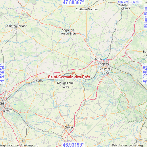
Saint-Germain-des-Prés GPS coordinates[2]
47° 24' 35.928" North, 0° 50' 0.312" West
| Map corner | latitude | longitude |
|---|---|---|
| Upper-left | 47.88367°, | -1.53654° |
| Center: | 47.40998°, | -0.83342° |
| Lower-right: | 46.93199°, | -0.13029° |
| Map W x H: | 105.8×105.8 km | = 65.7×65.7mi |
| max Lat: | 51.07786° ⇑50% North |
| Saint-Germain-des-Prés: | 47.40998° |
| min Lat: | ⇓50% South 41.3874° |
| min Long | Saint-Germain-d | max Long |
| -5.08615° | -0.83342° | 9.52242° |
| W 13.3%⇐ | ⇒86.7% E |
Elevation
Elevation of Saint-Germain-des-Prés is 17 m = 56 ft, and this is 176.7 m = 580 ft below average elevation for this country.
| Max E: |
2333 m = 7654 ft | 95% |
| Avg. | 193.7 m = 635 ft | |
| Saint-Germain-des-Prés | 17 m = 56 ft | |
Min E: |
-1 m = -3 ft | 5% |
See also: France elevation on elevation.city.
Geographical zone
Saint-Germain-des-Prés is located in North temperate zone (between Tropic of Cancer and the Arctic Circle). Distance of this North polar circle is 2129.7 km =1323.3 mi to North.| Distance of | km | miles | from Saint-Germain-des-Prés |
|---|---|---|---|
| North Pole | 4735.6 | 2942.6 | to North |
| Arctic Circle | 2129.7 | 1323.3 | to North |
| Tropic Cancer | 2665.6 | 1656.3 | to South |
| Equator | 5271.5 | 3275.6 | to South |


Nearby cities:
15 places around Saint-Germain-des-Prés: (largest is in red/bold)
• Bourgneuf-en-Mauges
10.8 km =6.7 mi,  180°
180°
• Bécon-les-Granits
10.5 km =6.5 mi,  13°
13°
• Chalonnes-sur-Loire
8.4 km =5.2 mi,  140°
140°
• Champtocé-sur-Loire
2.4 km =1.5 mi,  276°
276°
• Ingrandes
6.8 km =4.2 mi,  265°
265°
• La Pommeraye
6.3 km =3.9 mi,  197°
197°
• Le Fresne-sur-Loire
7.2 km =4.5 mi,  261°
261°
• Le Mesnil-en-Vallée
9.1 km =5.7 mi,  237°
237°
• Montjean-sur-Loire
3.1 km =1.9 mi,  218°
218°
• Saint-Augustin-des-Bois
6.2 km =3.9 mi,  27°
27°
• Saint-Georges-sur-Loire
5.4 km =3.4 mi,  92°
92°
• Saint-Laurent-de-la-Plaine
10.5 km =6.5 mi,  167°
167°
• Saint-Laurent-du-Mottay
10.9 km =6.8 mi,  233°
233°
• Saint-Martin-du-Fouilloux
10.1 km =6.3 mi,  74°
74°
• Villemoisan
7.5 km =4.7 mi,  323°
323°
Sources, notices
• [Note1] Compared only with cities in France existing in our database
• [Src1] Map data: © OpenStreetMap contributors (CC-BY-SA)
• [Src2] Other city data from geonames.org with taken over terms of usage.
• [Src3] Geographical zone / Annual Mean Temperature by Robert A. Rohde @ Wikipedia
