Montenay geodata
Montenay (Pays de la Loire) is a populated place; located in France in Europe/Paris (GMT+2) time zone. With population of 1,476 people, there are 6269 cities with bigger population in this country. Compared to other cities in France, 64.3% of cities are located further ↓South; 87.3% of cities are located further →East and 51.4% of cities have higher elevation than Montenay. Note1
Administrative division(s):
- Level 1: Pays de la Loire
- Level 2: Mayenne
- Level 3: Arrondissement de Mayenne
- Level 4: Montenay


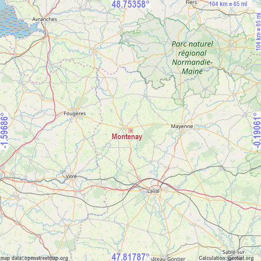
Montenay GPS coordinates[2]
48° 17' 16.332" North, 0° 53' 37.428" West
| Map corner | latitude | longitude |
|---|---|---|
| Upper-left | 48.75358°, | -1.59686° |
| Center: | 48.28787°, | -0.89373° |
| Lower-right: | 47.81787°, | -0.19061° |
| Map W x H: | 104×104 km | = 64.6×64.6mi |
| max Lat: | 51.07786° ⇑35.7% North |
| Montenay: | 48.28787° |
| min Lat: | ⇓64.3% South 41.3874° |
| min Long | Montenay | max Long |
| -5.08615° | -0.89373° | 9.52242° |
| W 12.7%⇐ | ⇒87.3% E |
Elevation
Elevation of Montenay is 127 m = 417 ft, and this is 66.7 m = 219 ft below average elevation for this country.
| Max E: |
2333 m = 7654 ft | 51.4% |
| Avg. | 193.7 m = 635 ft | |
| Montenay | 127 m = 417 ft | |
Min E: |
-1 m = -3 ft | 48.6% |
See also: France elevation on elevation.city.
Geographical zone
Montenay is located in North temperate zone (between Tropic of Cancer and the Arctic Circle). Distance of this North polar circle is 2032.1 km =1262.7 mi to North.| Distance of | km | miles | from Montenay |
|---|---|---|---|
| North Pole | 4638 | 2881.9 | to North |
| Arctic Circle | 2032.1 | 1262.7 | to North |
| Tropic Cancer | 2763.2 | 1717 | to South |
| Equator | 5369.1 | 3336.2 | to South |


Nearby cities:
15 places around Montenay: (largest is in red/bold)
• Andouillé
14.8 km =9.2 mi,  146°
146°
• Brecé
14.3 km =8.9 mi,  29°
29°
• Chailland
7.1 km =4.4 mi,  168°
168°
• Châtillon-sur-Colmont
12.4 km =7.7 mi,  63°
63°
• Colombiers-du-Plessis
12.2 km =7.6 mi,  19°
19°
• Ernée
3 km =1.9 mi,  291°
291°
• Gorron
14.9 km =9.3 mi, 23°
• Juvigné
12.3 km =7.6 mi,  237°
237°
• La Baconnière
12 km =7.5 mi,  179°
179°
• Larchamp
11.3 km =7 mi,  316°
316°
• Montaudin
12.9 km =8 mi,  326°
326°
• Saint-Denis-de-Gastines
6.6 km =4.1 mi, 23°
• Saint-Hilaire-du-Maine
7.3 km =4.5 mi,  201°
201°
• Saint-Pierre-des-Landes
10.1 km =6.3 mi,  261°
261°
• Vautorte
4.7 km =2.9 mi,  73°
73°
Sources, notices
• [Note1] Compared only with cities in France existing in our database
• [Src1] Map data: © OpenStreetMap contributors (CC-BY-SA)
• [Src2] Other city data from geonames.org with taken over terms of usage.
• [Src3] Geographical zone / Annual Mean Temperature by Robert A. Rohde @ Wikipedia
