Treffort-Cuisiat geodata
Treffort-Cuisiat (Auvergne-Rhône-Alpes) is a populated place; located in France in Europe/Paris (GMT+2) time zone. With population of 2,287 people, there are 4214 cities with bigger population in this country. Compared to other cities in France, 62.7% of cities are located further ↑North; 81.3% of cities are located further ←West and 81.4% of cities have lower elevation than Treffort-Cuisiat. Note1
Administrative division(s):
- Level 1: Auvergne-Rhône-Alpes
- Level 2: Département de l'Ain
- Level 3: Arrondissement de Bourg-en-Bresse
- Level 4: Val-Revermont


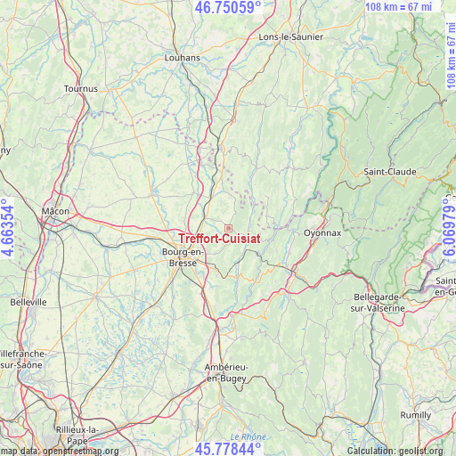
Treffort-Cuisiat GPS coordinates[2]
46° 16' 0.012" North, 5° 22' 0.012" East
| Map corner | latitude | longitude |
|---|---|---|
| Upper-left | 46.75059°, | 4.66354° |
| Center: | 46.26667°, | 5.36667° |
| Lower-right: | 45.77844°, | 6.06979° |
| Map W x H: | 108.1×108.1 km | = 67.2×67.2mi |
| max Lat: | 51.07786° ⇑62.7% North |
| Treffort-Cuisiat: | 46.26667° |
| min Lat: | ⇓37.3% South 41.3874° |
| min Long | Treffort-Cuisia | max Long |
| -5.08615° | 5.36667° | 9.52242° |
| W 81.3%⇐ | ⇒18.7% E |
Elevation
Elevation of Treffort-Cuisiat is 304 m = 997 ft, and this is 110.3 m = 362 ft above average elevation for this country.
| Max E: |
2333 m = 7654 ft | 18.6% |
| Treffort-Cuisiat | 304 m 997 ft | |
| Avg. | 193.7 m = 635 ft | |
Min E: |
-1 m = -3 ft | 81.4% |
See also: France elevation on elevation.city.
Geographical zone
Treffort-Cuisiat is located in North temperate zone (between Tropic of Cancer and the Arctic Circle). Distance of this North polar circle is 2256.8 km =1402.3 mi to North.| Distance of | km | miles | from Treffort-Cuisiat |
|---|---|---|---|
| North Pole | 4862.7 | 3021.5 | to North |
| Arctic Circle | 2256.8 | 1402.3 | to North |
| Tropic Cancer | 2538.5 | 1577.4 | to South |
| Equator | 5144.4 | 3196.6 | to South |


Nearby cities:
15 places around Treffort-Cuisiat: (largest is in red/bold)
• Aromas
9.2 km =5.7 mi,  71°
71°
• Bény
8.8 km =5.5 mi,  315°
315°
• Ceyzériat
10.2 km =6.3 mi,  200°
200°
• Champagne
11.5 km =7.1 mi,  256°
256°
• Chavannes-sur-Suran
4.7 km =2.9 mi,  94°
94°
• Corveissiat
9.2 km =5.7 mi,  105°
105°
• Cuisiat
4.1 km =2.5 mi,  23°
23°
• Granges
10.6 km =6.6 mi, 107°
• Jasseron
6.7 km =4.2 mi,  207°
207°
• Meillonnas
2.9 km =1.8 mi, 206°
• Saint-Just
10.8 km =6.7 mi,  218°
218°
• Saint-Étienne-du-Bois
6.1 km =3.8 mi,  295°
295°
• Simandre-sur-Suran
5.9 km =3.7 mi,  138°
138°
• Villemotier
9.5 km =5.9 mi,  338°
338°
• Villereversure
9.1 km =5.7 mi,  172°
172°
Sources, notices
• [Note1] Compared only with cities in France existing in our database
• [Src1] Map data: © OpenStreetMap contributors (CC-BY-SA)
• [Src2] Other city data from geonames.org with taken over terms of usage.
• [Src3] Geographical zone / Annual Mean Temperature by Robert A. Rohde @ Wikipedia
