Caurel geodata
Caurel (Grand Est) is a populated place; located in France in Europe/Paris (GMT+2) time zone. With population of 662 people, there are 12351 cities with bigger population in this country. Compared to other cities in France, 86.2% of cities are located further ↓South; 69.3% of cities are located further ←West and 56.9% of cities have higher elevation than Caurel. Note1
Administrative division(s):
- Level 1: Grand Est
- Level 2: Marne
- Level 3: Arrondissement de Reims
- Level 4: Caurel


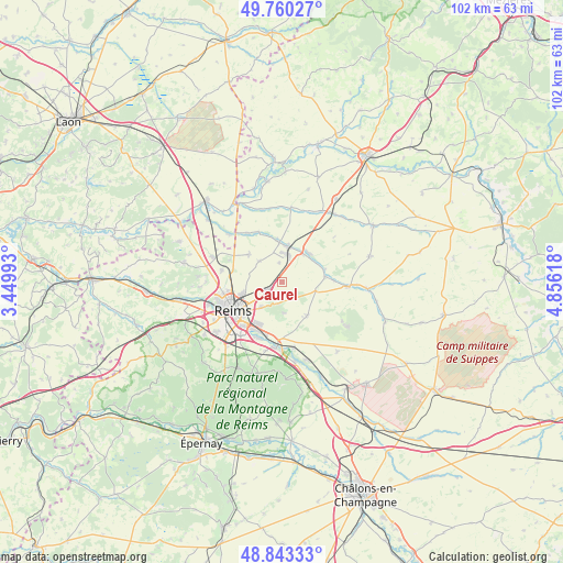
Caurel GPS coordinates[2]
49° 18' 14.148" North, 4° 9' 10.98" East
| Map corner | latitude | longitude |
|---|---|---|
| Upper-left | 49.76027°, | 3.44993° |
| Center: | 49.30393°, | 4.15305° |
| Lower-right: | 48.84333°, | 4.85618° |
| Map W x H: | 102×102 km | = 63.4×63.4mi |
| max Lat: | 51.07786° ⇑13.8% North |
| Caurel: | 49.30393° |
| min Lat: | ⇓86.2% South 41.3874° |
| min Long | Caurel | max Long |
| -5.08615° | 4.15305° | 9.52242° |
| W 69.3%⇐ | ⇒30.7% E |
Elevation
Elevation of Caurel is 111 m = 364 ft, and this is 82.7 m = 271 ft below average elevation for this country.
| Max E: |
2333 m = 7654 ft | 56.9% |
| Avg. | 193.7 m = 635 ft | |
| Caurel | 111 m = 364 ft | |
Min E: |
-1 m = -3 ft | 43.1% |
See also: France elevation on elevation.city.
Geographical zone
Caurel is located in North temperate zone (between Tropic of Cancer and the Arctic Circle). Distance of this North polar circle is 1919.1 km =1192.5 mi to North.| Distance of | km | miles | from Caurel |
|---|---|---|---|
| North Pole | 4525 | 2811.7 | to North |
| Arctic Circle | 1919.1 | 1192.5 | to North |
| Tropic Cancer | 2876.2 | 1787.2 | to South |
| Equator | 5482.1 | 3406.4 | to South |


Nearby cities:
15 places around Caurel: (largest is in red/bold)
• Auménancourt-le-Petit
10.5 km =6.5 mi,  319°
319°
• Bazancourt
7 km =4.3 mi,  10°
10°
• Beine-Nauroy
7.6 km =4.7 mi,  143°
143°
• Boult-sur-Suippe
7.5 km =4.7 mi,  356°
356°
• Bourgogne
7.8 km =4.8 mi,  310°
310°
• Bétheny
7.4 km =4.6 mi,  253°
253°
• Cernay-lès-Reims
5.8 km =3.6 mi,  219°
219°
• Courcy
11.1 km =6.9 mi,  281°
281°
• Isles-sur-Suippe
6.7 km =4.2 mi,  31°
31°
• Reims
10 km =6.2 mi,  244°
244°
• Saint-Masmes
7.9 km =4.9 mi,  83°
83°
• Sillery
11.8 km =7.3 mi,  187°
187°
• Taissy
10.8 km =6.7 mi,  203°
203°
• Warmeriville
7.2 km =4.5 mi,  41°
41°
• Witry-lès-Reims
2.8 km =1.7 mi, 240°
Sources, notices
• [Note1] Compared only with cities in France existing in our database
• [Src1] Map data: © OpenStreetMap contributors (CC-BY-SA)
• [Src2] Other city data from geonames.org with taken over terms of usage.
• [Src3] Geographical zone / Annual Mean Temperature by Robert A. Rohde @ Wikipedia
