Cauneille geodata
Cauneille (Nouvelle-Aquitaine) is a populated place; located in France in Europe/Paris (GMT+2) time zone. With population of 767 people, there are 10982 cities with bigger population in this country. Compared to other cities in France, 92.5% of cities are located further ↑North; 88.7% of cities are located further →East and 96.3% of cities have higher elevation than Cauneille. Note1
Administrative division(s):
- Level 1: Nouvelle-Aquitaine
- Level 2: Landes
- Level 3: Arrondissement de Dax
- Level 4: Cauneille


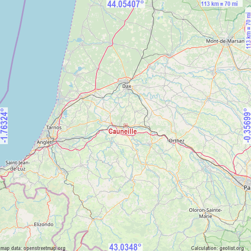
Cauneille GPS coordinates[2]
43° 32' 47.724" North, 1° 3' 36.396" West
| Map corner | latitude | longitude |
|---|---|---|
| Upper-left | 44.05407°, | -1.76324° |
| Center: | 43.54659°, | -1.06011° |
| Lower-right: | 43.0348°, | -0.35699° |
| Map W x H: | 113.3×113.3 km | = 70.4×70.4mi |
| max Lat: | 51.07786° ⇑92.5% North |
| Cauneille: | 43.54659° |
| min Lat: | ⇓7.5% South 41.3874° |
| min Long | Cauneille | max Long |
| -5.08615° | -1.06011° | 9.52242° |
| W 11.3%⇐ | ⇒88.7% E |
Elevation
Elevation of Cauneille is 13 m = 43 ft, and this is 180.7 m = 593 ft below average elevation for this country.
| Max E: |
2333 m = 7654 ft | 96.3% |
| Avg. | 193.7 m = 635 ft | |
| Cauneille | 13 m = 43 ft | |
Min E: |
-1 m = -3 ft | 3.7% |
See also: France elevation on elevation.city.
Geographical zone
Cauneille is located in North temperate zone (between Tropic of Cancer and the Arctic Circle). Distance of this Northern Tropic circle is 2236 km =1389.4 mi to South.| Distance of | km | miles | from Cauneille |
|---|---|---|---|
| North Pole | 5165.1 | 3209.4 | to North |
| Arctic Circle | 2559.2 | 1590.2 | to North |
| Tropic Cancer | 2236 | 1389.4 | to South |
| Equator | 4841.9 | 3008.6 | to South |


Nearby cities:
15 places around Cauneille: (largest is in red/bold)
• Bellocq
12 km =7.5 mi,  106°
106°
• Bidache
9.6 km =6 mi,  222°
222°
• Cagnotte
5.4 km =3.4 mi,  353°
353°
• Came
9.6 km =6 mi,  210°
210°
• Carresse-Cassaber
8.5 km =5.3 mi,  145°
145°
• Habas
10.9 km =6.8 mi,  75°
75°
• Heugas
10.9 km =6.8 mi, 350°
• Labatut
6.2 km =3.9 mi,  86°
86°
• Misson
9.6 km =6 mi,  58°
58°
• Orthevielle
7.1 km =4.4 mi,  275°
275°
• Peyrehorade
4.5 km =2.8 mi,  273°
273°
• Port-de-Lanne
9.7 km =6 mi, 281°
• Pouillon
8.1 km =5 mi,  37°
37°
• Puyoô
12.1 km =7.5 mi,  101°
101°
• Saint-Lon-les-Mines
9.1 km =5.7 mi,  323°
323°
Sources, notices
• [Note1] Compared only with cities in France existing in our database
• [Src1] Map data: © OpenStreetMap contributors (CC-BY-SA)
• [Src2] Other city data from geonames.org with taken over terms of usage.
• [Src3] Geographical zone / Annual Mean Temperature by Robert A. Rohde @ Wikipedia
