Peyrehorade geodata
Peyrehorade (Nouvelle-Aquitaine) is a populated place; located in France in Europe/Paris (GMT+2) time zone. With population of 3,419 people, there are 2847 cities with bigger population in this country. Compared to other cities in France, 92.5% of cities are located further ↑North; 89.3% of cities are located further →East and 97.8% of cities have higher elevation than Peyrehorade. Note1
Administrative division(s):
- Level 1: Nouvelle-Aquitaine
- Level 2: Landes
- Level 3: Arrondissement de Dax
- Level 4: Peyrehorade


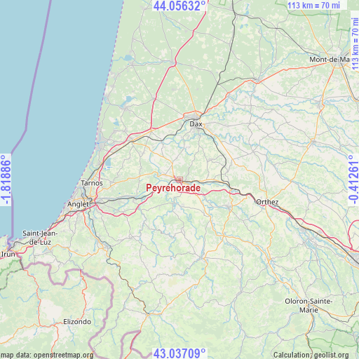
Peyrehorade GPS coordinates[2]
43° 32' 55.896" North, 1° 6' 56.664" West
| Map corner | latitude | longitude |
|---|---|---|
| Upper-left | 44.05632°, | -1.81886° |
| Center: | 43.54886°, | -1.11574° |
| Lower-right: | 43.03709°, | -0.41261° |
| Map W x H: | 113.3×113.3 km | = 70.4×70.4mi |
| max Lat: | 51.07786° ⇑92.5% North |
| Peyrehorade: | 43.54886° |
| min Lat: | ⇓7.5% South 41.3874° |
| min Long | Peyrehorade | max Long |
| -5.08615° | -1.11574° | 9.52242° |
| W 10.7%⇐ | ⇒89.3% E |
Elevation
Elevation of Peyrehorade is 9 m = 30 ft, and this is 184.7 m = 606 ft below average elevation for this country.
| Max E: |
2333 m = 7654 ft | 97.8% |
| Avg. | 193.7 m = 635 ft | |
| Peyrehorade | 9 m = 30 ft | |
Min E: |
-1 m = -3 ft | 2.2% |
See also: France elevation on elevation.city.
Geographical zone
Peyrehorade is located in North temperate zone (between Tropic of Cancer and the Arctic Circle). Distance of this Northern Tropic circle is 2236.3 km =1389.6 mi to South.| Distance of | km | miles | from Peyrehorade |
|---|---|---|---|
| North Pole | 5164.9 | 3209.3 | to North |
| Arctic Circle | 2559 | 1590.1 | to North |
| Tropic Cancer | 2236.3 | 1389.6 | to South |
| Equator | 4842.2 | 3008.8 | to South |


Nearby cities:
15 places around Peyrehorade: (largest is in red/bold)
• Bardos
10.9 km =6.8 mi,  220°
220°
• Bidache
7.6 km =4.7 mi,  195°
195°
• Cagnotte
6.4 km =4 mi,  36°
36°
• Came
8.5 km =5.3 mi,  182°
182°
• Carresse-Cassaber
11.8 km =7.3 mi,  127°
127°
• Cauneille
4.5 km =2.8 mi,  93°
93°
• Guiche
8.3 km =5.2 mi,  240°
240°
• Heugas
10.9 km =6.8 mi,  14°
14°
• Labatut
10.7 km =6.6 mi, 89°
• Orist
11.4 km =7.1 mi,  334°
334°
• Orthevielle
2.6 km =1.6 mi,  278°
278°
• Pey
11.2 km =7 mi,  322°
322°
• Port-de-Lanne
5.3 km =3.3 mi,  288°
288°
• Pouillon
11.2 km =7 mi,  56°
56°
• Saint-Lon-les-Mines
7.2 km =4.5 mi,  352°
352°
Sources, notices
• [Note1] Compared only with cities in France existing in our database
• [Src1] Map data: © OpenStreetMap contributors (CC-BY-SA)
• [Src2] Other city data from geonames.org with taken over terms of usage.
• [Src3] Geographical zone / Annual Mean Temperature by Robert A. Rohde @ Wikipedia
