Caudrot geodata
Caudrot (Nouvelle-Aquitaine) is a populated place; located in France in Europe/Paris (GMT+2) time zone. With population of 945 people, there are 9241 cities with bigger population in this country. Compared to other cities in France, 83% of cities are located further ↑North; 79.1% of cities are located further →East and 93.6% of cities have higher elevation than Caudrot. Note1
Administrative division(s):
- Level 1: Nouvelle-Aquitaine
- Level 2: Gironde
- Level 3: Arrondissement de Langon
- Level 4: Caudrot


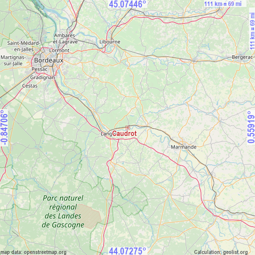
Caudrot GPS coordinates[2]
44° 34' 32.736" North, 0° 8' 38.148" West
| Map corner | latitude | longitude |
|---|---|---|
| Upper-left | 45.07446°, | -0.84706° |
| Center: | 44.57576°, | -0.14393° |
| Lower-right: | 44.07275°, | 0.55919° |
| Map W x H: | 111.4×111.4 km | = 69.2×69.2mi |
| max Lat: | 51.07786° ⇑83% North |
| Caudrot: | 44.57576° |
| min Lat: | ⇓17% South 41.3874° |
| min Long | Caudrot | max Long |
| -5.08615° | -0.14393° | 9.52242° |
| W 20.9%⇐ | ⇒79.1% E |
Elevation
Elevation of Caudrot is 21 m = 69 ft, and this is 172.7 m = 567 ft below average elevation for this country.
| Max E: |
2333 m = 7654 ft | 93.6% |
| Avg. | 193.7 m = 635 ft | |
| Caudrot | 21 m = 69 ft | |
Min E: |
-1 m = -3 ft | 6.4% |
See also: France elevation on elevation.city.
Geographical zone
Caudrot is located in North temperate zone (between Tropic of Cancer and the Arctic Circle). Distance of this Northern Tropic circle is 2350.4 km =1460.5 mi to South.| Distance of | km | miles | from Caudrot |
|---|---|---|---|
| North Pole | 5050.7 | 3138.4 | to North |
| Arctic Circle | 2444.8 | 1519.1 | to North |
| Tropic Cancer | 2350.4 | 1460.5 | to South |
| Equator | 4956.4 | 3079.8 | to South |


Nearby cities:
15 places around Caudrot: (largest is in red/bold)
• Auros
9 km =5.6 mi,  180°
180°
• Castets-en-Dorthe
1.7 km =1.1 mi,  202°
202°
• Fontet
9.1 km =5.7 mi,  101°
101°
• Gironde-sur-Dropt
4.9 km =3 mi,  80°
80°
• La Réole
8.5 km =5.3 mi,  85°
85°
• Langon
8.7 km =5.4 mi,  253°
253°
• Le Pian-sur-Garonne
5.6 km =3.5 mi,  281°
281°
• Morizès
5.9 km =3.7 mi,  46°
46°
• Saint-Macaire
6.5 km =4 mi,  259°
259°
• Saint-Maixant
9.1 km =5.7 mi,  272°
272°
• Saint-Martin-de-Sescas
1.4 km =0.9 mi, 268°
• Saint-Pierre-d’Aurillac
3.6 km =2.2 mi, 262°
• Savignac
6.6 km =4.1 mi,  154°
154°
• Toulenne
9.7 km =6 mi, 257°
• Verdelais
8.5 km =5.3 mi, 279°
Sources, notices
• [Note1] Compared only with cities in France existing in our database
• [Src1] Map data: © OpenStreetMap contributors (CC-BY-SA)
• [Src2] Other city data from geonames.org with taken over terms of usage.
• [Src3] Geographical zone / Annual Mean Temperature by Robert A. Rohde @ Wikipedia
