Cases-de-Pène geodata
Cases-de-Pène (Occitanie) is a populated place; located in France in Europe/Paris (GMT+2) time zone. With population of 610 people, there are 13160 cities with bigger population in this country. Compared to other cities in France, 98.8% of cities are located further ↑North; 54.7% of cities are located further ←West and 79.8% of cities have higher elevation than Cases-de-Pène. Note1
Administrative division(s):
- Level 1: Occitanie
- Level 2: Département des Pyrénées-Orientales
- Level 3: Arrondissement de Perpignan
- Level 4: Cases-de-Pène


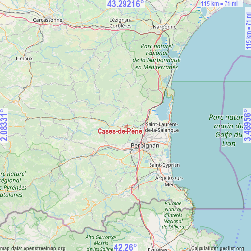
Cases-de-Pène GPS coordinates[2]
42° 46' 41.628" North, 2° 47' 11.148" East
| Map corner | latitude | longitude |
|---|---|---|
| Upper-left | 43.29216°, | 2.08331° |
| Center: | 42.77823°, | 2.78643° |
| Lower-right: | 42.26°, | 3.48956° |
| Map W x H: | 114.8×114.8 km | = 71.3×71.3mi |
| max Lat: | 51.07786° ⇑98.8% North |
| Cases-de-Pène: | 42.77823° |
| min Lat: | ⇓1.2% South 41.3874° |
| min Long | Cases-de-Pène | max Long |
| -5.08615° | 2.78643° | 9.52242° |
| W 54.7%⇐ | ⇒45.3% E |
Elevation
Elevation of Cases-de-Pène is 55 m = 180 ft, and this is 138.7 m = 455 ft below average elevation for this country.
| Max E: |
2333 m = 7654 ft | 79.8% |
| Avg. | 193.7 m = 635 ft | |
| Cases-de-Pène | 55 m = 180 ft | |
Min E: |
-1 m = -3 ft | 20.2% |
See also: France elevation on elevation.city.
Geographical zone
Cases-de-Pène is located in North temperate zone (between Tropic of Cancer and the Arctic Circle). Distance of this Northern Tropic circle is 2150.6 km =1336.3 mi to South.| Distance of | km | miles | from Cases-de-Pène |
|---|---|---|---|
| North Pole | 5250.6 | 3262.6 | to North |
| Arctic Circle | 2644.7 | 1643.3 | to North |
| Tropic Cancer | 2150.6 | 1336.3 | to South |
| Equator | 4756.5 | 2955.6 | to South |


Nearby cities:
15 places around Cases-de-Pène: (largest is in red/bold)
• Baho
9.2 km =5.7 mi,  161°
161°
• Baixas
3.7 km =2.3 mi,  148°
148°
• Corneilla-la-Rivière
10.2 km =6.3 mi,  207°
207°
• Estagel
7.3 km =4.5 mi,  265°
265°
• Latour-de-France
10.9 km =6.8 mi,  263°
263°
• Le Soler
10.8 km =6.7 mi,  177°
177°
• Paziols
10.5 km =6.5 mi,  328°
328°
• Peyrestortes
6 km =3.7 mi,  115°
115°
• Pézilla-la-Rivière
9.3 km =5.8 mi,  187°
187°
• Rivesaltes
7.1 km =4.4 mi,  97°
97°
• Saint-Estève
8.8 km =5.5 mi, 147°
• Saint-Féliu-d’Amont
11.4 km =7.1 mi, 206°
• Tautavel
5.2 km =3.2 mi,  320°
320°
• Villeneuve-la-Rivière
9.5 km =5.9 mi,  171°
171°
• Vingrau
7.8 km =4.8 mi,  354°
354°
Sources, notices
• [Note1] Compared only with cities in France existing in our database
• [Src1] Map data: © OpenStreetMap contributors (CC-BY-SA)
• [Src2] Other city data from geonames.org with taken over terms of usage.
• [Src3] Geographical zone / Annual Mean Temperature by Robert A. Rohde @ Wikipedia
