Paziols geodata
Paziols (Occitanie) is a populated place; located in France in Europe/Paris (GMT+2) time zone. With population of 551 people, there are 14194 cities with bigger population in this country. Compared to other cities in France, 98.7% of cities are located further ↑North; 53.8% of cities are located further ←West and 51.9% of cities have lower elevation than Paziols. Note1
Administrative division(s):
- Level 1: Occitanie
- Level 2: Département de l'Aude
- Level 3: Arrondissement de Narbonne
- Level 4: Paziols


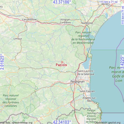
Paziols GPS coordinates[2]
42° 51' 30.96" North, 2° 43' 9.732" East
| Map corner | latitude | longitude |
|---|---|---|
| Upper-left | 43.37186°, | 2.01625° |
| Center: | 42.8586°, | 2.71937° |
| Lower-right: | 42.34103°, | 3.4225° |
| Map W x H: | 114.6×114.6 km | = 71.2×71.2mi |
| max Lat: | 51.07786° ⇑98.7% North |
| Paziols: | 42.8586° |
| min Lat: | ⇓1.3% South 41.3874° |
| min Long | Paziols | max Long |
| -5.08615° | 2.71937° | 9.52242° |
| W 53.8%⇐ | ⇒46.2% E |
Elevation
Elevation of Paziols is 139 m = 456 ft, and this is 54.7 m = 179 ft below average elevation for this country.
| Max E: |
2333 m = 7654 ft | 48.1% |
| Avg. | 193.7 m = 635 ft | |
| Paziols | 139 m = 456 ft | |
Min E: |
-1 m = -3 ft | 51.9% |
See also: France elevation on elevation.city.
Geographical zone
Paziols is located in North temperate zone (between Tropic of Cancer and the Arctic Circle). Distance of this Northern Tropic circle is 2159.5 km =1341.9 mi to South.| Distance of | km | miles | from Paziols |
|---|---|---|---|
| North Pole | 5241.6 | 3257 | to North |
| Arctic Circle | 2635.7 | 1637.7 | to North |
| Tropic Cancer | 2159.5 | 1341.9 | to South |
| Equator | 4765.4 | 2961.1 | to South |


Nearby cities:
15 places around Paziols: (largest is in red/bold)
• Baixas
14.2 km =8.8 mi,  148°
148°
• Cases-de-Pène
10.5 km =6.5 mi, 148°
• Corneilla-la-Rivière
18 km =11.2 mi,  177°
177°
• Durban-Corbières
17.1 km =10.6 mi,  27°
27°
• Estagel
9.7 km =6 mi,  191°
191°
• Latour-de-France
11.4 km =7.1 mi,  208°
208°
• Maury
11.5 km =7.1 mi,  242°
242°
• Opoul-Périllos
13.4 km =8.3 mi,  86°
86°
• Peyrestortes
15.8 km =9.8 mi,  136°
136°
• Rivesaltes
15.9 km =9.9 mi,  128°
128°
• Saint-Paul-de-Fenouillet
18.4 km =11.4 mi,  252°
252°
• Salses-le-Château
16.3 km =10.1 mi,  99°
99°
• Tautavel
5.4 km =3.4 mi,  155°
155°
• Tuchan
3.3 km =2.1 mi,  359°
359°
• Vingrau
4.9 km =3 mi, 103°
Sources, notices
• [Note1] Compared only with cities in France existing in our database
• [Src1] Map data: © OpenStreetMap contributors (CC-BY-SA)
• [Src2] Other city data from geonames.org with taken over terms of usage.
• [Src3] Geographical zone / Annual Mean Temperature by Robert A. Rohde @ Wikipedia
