Cancale geodata
Cancale (Brittany) is a populated place; located in France in Europe/Paris (GMT+2) time zone. With population of 5,751 people, there are 1717 cities with bigger population in this country. Compared to other cities in France, 72.6% of cities are located further ↓South; 94.3% of cities are located further →East and 83.1% of cities have higher elevation than Cancale. Note1
Administrative division(s):
- Level 1: Brittany
- Level 2: Département d'Ille-et-Vilaine
- Level 3: Arrondissement de Saint-Malo
- Level 4: Cancale


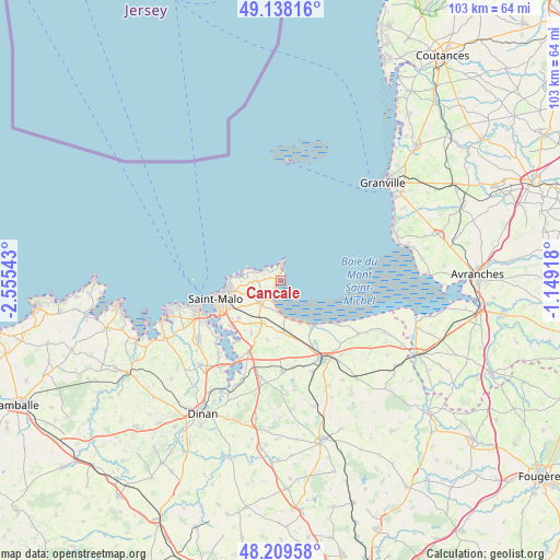
Cancale GPS coordinates[2]
48° 40' 33.636" North, 1° 51' 8.316" West
| Map corner | latitude | longitude |
|---|---|---|
| Upper-left | 49.13816°, | -2.55543° |
| Center: | 48.67601°, | -1.85231° |
| Lower-right: | 48.20958°, | -1.14918° |
| Map W x H: | 103.2×103.2 km | = 64.1×64.1mi |
| max Lat: | 51.07786° ⇑27.4% North |
| Cancale: | 48.67601° |
| min Lat: | ⇓72.6% South 41.3874° |
| min Long | Cancale | max Long |
| -5.08615° | -1.85231° | 9.52242° |
| W 5.7%⇐ | ⇒94.3% E |
Elevation
Elevation of Cancale is 47 m = 154 ft, and this is 146.7 m = 481 ft below average elevation for this country.
| Max E: |
2333 m = 7654 ft | 83.1% |
| Avg. | 193.7 m = 635 ft | |
| Cancale | 47 m = 154 ft | |
Min E: |
-1 m = -3 ft | 16.9% |
See also: France elevation on elevation.city.
Geographical zone
Cancale is located in North temperate zone (between Tropic of Cancer and the Arctic Circle). Distance of this North polar circle is 1988.9 km =1235.8 mi to North.| Distance of | km | miles | from Cancale |
|---|---|---|---|
| North Pole | 4594.8 | 2855.1 | to North |
| Arctic Circle | 1988.9 | 1235.8 | to North |
| Tropic Cancer | 2806.3 | 1743.8 | to South |
| Equator | 5412.3 | 3363 | to South |


Nearby cities:
15 places around Cancale: (largest is in red/bold)
• Cherrueix
13.4 km =8.3 mi,  125°
125°
• Châteauneuf-d’Ille-et-Vilaine
14 km =8.7 mi,  203°
203°
• Hirel
8.7 km =5.4 mi,  155°
155°
• La Fresnais
9.1 km =5.7 mi,  175°
175°
• La Gouesnière
8.5 km =5.3 mi, 201°
• Le Vivier-sur-Mer
10.1 km =6.3 mi,  144°
144°
• Roz-Landrieux
15 km =9.3 mi,  169°
169°
• Saint-Benoît-des-Ondes
6.5 km =4 mi, 178°
• Saint-Coulomb
4.3 km =2.7 mi,  267°
267°
• Saint-Guinoux
11.4 km =7.1 mi,  191°
191°
• Saint-Jouan-des-Guérets
12.3 km =7.6 mi,  226°
226°
• Saint-Malo
11.9 km =7.4 mi,  254°
254°
• Saint-Méloir-des-Ondes
5.7 km =3.5 mi,  222°
222°
• Saint-Père
11.2 km =7 mi,  208°
208°
• Saint-Suliac
14.7 km =9.1 mi, 216°
Sources, notices
• [Note1] Compared only with cities in France existing in our database
• [Src1] Map data: © OpenStreetMap contributors (CC-BY-SA)
• [Src2] Other city data from geonames.org with taken over terms of usage.
• [Src3] Geographical zone / Annual Mean Temperature by Robert A. Rohde @ Wikipedia
