Campbon geodata
Campbon (Pays de la Loire) is a populated place; located in France in Europe/Paris (GMT+2) time zone. With population of 3,327 people, there are 2933 cities with bigger population in this country. Compared to other cities in France, 50.1% of cities are located further ↓South; 94.7% of cities are located further →East and 87.4% of cities have higher elevation than Campbon. Note1
Administrative division(s):
- Level 1: Pays de la Loire
- Level 2: Loire-Atlantique
- Level 3: Arrondissement de Saint-Nazaire
- Level 4: Campbon


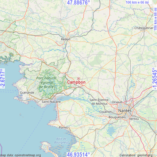
Campbon GPS coordinates[2]
47° 24' 47.16" North, 1° 58' 6.852" West
| Map corner | latitude | longitude |
|---|---|---|
| Upper-left | 47.88676°, | -2.6717° |
| Center: | 47.4131°, | -1.96857° |
| Lower-right: | 46.93514°, | -1.26545° |
| Map W x H: | 105.8×105.8 km | = 65.7×65.7mi |
| max Lat: | 51.07786° ⇑49.9% North |
| Campbon: | 47.4131° |
| min Lat: | ⇓50.1% South 41.3874° |
| min Long | Campbon | max Long |
| -5.08615° | -1.96857° | 9.52242° |
| W 5.3%⇐ | ⇒94.7% E |
Elevation
Elevation of Campbon is 36 m = 118 ft, and this is 157.7 m = 517 ft below average elevation for this country.
| Max E: |
2333 m = 7654 ft | 87.4% |
| Avg. | 193.7 m = 635 ft | |
| Campbon | 36 m = 118 ft | |
Min E: |
-1 m = -3 ft | 12.6% |
See also: France elevation on elevation.city.
Geographical zone
Campbon is located in North temperate zone (between Tropic of Cancer and the Arctic Circle). Distance of this North polar circle is 2129.3 km =1323.1 mi to North.| Distance of | km | miles | from Campbon |
|---|---|---|---|
| North Pole | 4735.2 | 2942.3 | to North |
| Arctic Circle | 2129.3 | 1323.1 | to North |
| Tropic Cancer | 2665.9 | 1656.5 | to South |
| Equator | 5271.8 | 3275.7 | to South |


Nearby cities:
15 places around Campbon: (largest is in red/bold)
• Besné
9.2 km =5.7 mi,  260°
260°
• Bouvron
9.2 km =5.7 mi,  87°
87°
• Bouée
11.3 km =7 mi,  156°
156°
• Drefféac
9.6 km =6 mi,  315°
315°
• Fay-de-Bretagne
13.3 km =8.3 mi, 89°
• Guenrouet
11.8 km =7.3 mi,  5°
5°
• La Chapelle-Launay
4.5 km =2.8 mi,  182°
182°
• Lavau-sur-Loire
11.8 km =7.3 mi, 179°
• Malville
10 km =6.2 mi,  126°
126°
• Pontchâteau
9.6 km =6 mi,  286°
286°
• Prinquiau
6.4 km =4 mi,  208°
208°
• Quilly
5.5 km =3.4 mi, 12°
• Saint-Gildas-des-Bois
12.6 km =7.8 mi,  335°
335°
• Sainte-Anne-sur-Brivet
5.9 km =3.7 mi,  333°
333°
• Savenay
6.2 km =3.9 mi, 161°
Sources, notices
• [Note1] Compared only with cities in France existing in our database
• [Src1] Map data: © OpenStreetMap contributors (CC-BY-SA)
• [Src2] Other city data from geonames.org with taken over terms of usage.
• [Src3] Geographical zone / Annual Mean Temperature by Robert A. Rohde @ Wikipedia
