Quilly geodata
Quilly (Pays de la Loire) is a populated place; located in France in Europe/Paris (GMT+2) time zone. With population of 1,001 people, there are 8828 cities with bigger population in this country. Compared to other cities in France, 50.6% of cities are located further ↓South; 94.7% of cities are located further →East and 93.9% of cities have higher elevation than Quilly. Note1
Administrative division(s):
- Level 1: Pays de la Loire
- Level 2: Loire-Atlantique
- Level 3: Arrondissement de Saint-Nazaire
- Level 4: Quilly


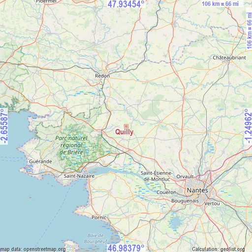
Quilly GPS coordinates[2]
47° 27' 40.716" North, 1° 57' 9.864" West
| Map corner | latitude | longitude |
|---|---|---|
| Upper-left | 47.93454°, | -2.65587° |
| Center: | 47.46131°, | -1.95274° |
| Lower-right: | 46.98379°, | -1.24962° |
| Map W x H: | 105.7×105.7 km | = 65.7×65.7mi |
| max Lat: | 51.07786° ⇑49.4% North |
| Quilly: | 47.46131° |
| min Lat: | ⇓50.6% South 41.3874° |
| min Long | Quilly | max Long |
| -5.08615° | -1.95274° | 9.52242° |
| W 5.3%⇐ | ⇒94.7% E |
Elevation
Elevation of Quilly is 20 m = 66 ft, and this is 173.7 m = 570 ft below average elevation for this country.
| Max E: |
2333 m = 7654 ft | 93.9% |
| Avg. | 193.7 m = 635 ft | |
| Quilly | 20 m = 66 ft | |
Min E: |
-1 m = -3 ft | 6.1% |
See also: France elevation on elevation.city.
Geographical zone
Quilly is located in North temperate zone (between Tropic of Cancer and the Arctic Circle). Distance of this North polar circle is 2124 km =1319.8 mi to North.| Distance of | km | miles | from Quilly |
|---|---|---|---|
| North Pole | 4729.9 | 2939 | to North |
| Arctic Circle | 2124 | 1319.8 | to North |
| Tropic Cancer | 2671.3 | 1659.9 | to South |
| Equator | 5277.2 | 3279.1 | to South |


Nearby cities:
15 places around Quilly: (largest is in red/bold)
• Besné
12.4 km =7.7 mi,  236°
236°
• Bouvron
9.4 km =5.8 mi,  121°
121°
• Campbon
5.5 km =3.4 mi,  192°
192°
• Drefféac
8 km =5 mi,  280°
280°
• Fay-de-Bretagne
13.2 km =8.2 mi,  113°
113°
• Guenrouet
6.4 km =4 mi,  359°
359°
• La Chapelle-Launay
10 km =6.2 mi, 187°
• Malville
13.3 km =8.3 mi,  149°
149°
• Plessé
10.3 km =6.4 mi,  29°
29°
• Pontchâteau
10.6 km =6.6 mi,  255°
255°
• Prinquiau
11.8 km =7.3 mi,  201°
201°
• Saint-Gildas-des-Bois
8.8 km =5.5 mi,  314°
314°
• Sainte-Anne-sur-Brivet
3.9 km =2.4 mi,  269°
269°
• Savenay
11.2 km =7 mi,  175°
175°
• Sévérac
13.5 km =8.4 mi,  317°
317°
Sources, notices
• [Note1] Compared only with cities in France existing in our database
• [Src1] Map data: © OpenStreetMap contributors (CC-BY-SA)
• [Src2] Other city data from geonames.org with taken over terms of usage.
• [Src3] Geographical zone / Annual Mean Temperature by Robert A. Rohde @ Wikipedia
