Savenay geodata
Savenay (Pays de la Loire) is a populated place; located in France in Europe/Paris (GMT+2) time zone. With population of 6,770 people, there are 1463 cities with bigger population in this country. Compared to other cities in France, 50.6% of cities are located further ↑North; 94.6% of cities are located further →East and 79.4% of cities have higher elevation than Savenay. Note1
Administrative division(s):
- Level 1: Pays de la Loire
- Level 2: Loire-Atlantique
- Level 3: Arrondissement de Saint-Nazaire
- Level 4: Savenay


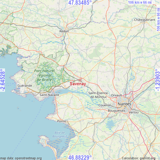
Savenay GPS coordinates[2]
47° 21' 38.592" North, 1° 56' 31.74" West
| Map corner | latitude | longitude |
|---|---|---|
| Upper-left | 47.83485°, | -2.64528° |
| Center: | 47.36072°, | -1.94215° |
| Lower-right: | 46.88229°, | -1.23903° |
| Map W x H: | 105.9×105.9 km | = 65.8×65.8mi |
| max Lat: | 51.07786° ⇑50.6% North |
| Savenay: | 47.36072° |
| min Lat: | ⇓49.4% South 41.3874° |
| min Long | Savenay | max Long |
| -5.08615° | -1.94215° | 9.52242° |
| W 5.4%⇐ | ⇒94.6% E |
Elevation
Elevation of Savenay is 56 m = 184 ft, and this is 137.7 m = 452 ft below average elevation for this country.
| Max E: |
2333 m = 7654 ft | 79.4% |
| Avg. | 193.7 m = 635 ft | |
| Savenay | 56 m = 184 ft | |
Min E: |
-1 m = -3 ft | 20.6% |
See also: France elevation on elevation.city.
Geographical zone
Savenay is located in North temperate zone (between Tropic of Cancer and the Arctic Circle). Distance of this North polar circle is 2135.2 km =1326.8 mi to North.| Distance of | km | miles | from Savenay |
|---|---|---|---|
| North Pole | 4741 | 2945.9 | to North |
| Arctic Circle | 2135.2 | 1326.8 | to North |
| Tropic Cancer | 2660.1 | 1652.9 | to South |
| Equator | 5266 | 3272.1 | to South |


Nearby cities:
15 places around Savenay: (largest is in red/bold)
• Besné
11.9 km =7.4 mi,  291°
291°
• Bouvron
9.5 km =5.9 mi,  48°
48°
• Bouée
5.1 km =3.2 mi,  151°
151°
• Campbon
6.2 km =3.9 mi,  341°
341°
• Cordemais
9.1 km =5.7 mi, 148°
• Donges
11.1 km =6.9 mi,  244°
244°
• Fay-de-Bretagne
12.8 km =8 mi,  62°
62°
• La Chapelle-Launay
2.5 km =1.6 mi,  300°
300°
• Lavau-sur-Loire
6.2 km =3.9 mi,  196°
196°
• Le Temple-de-Bretagne
12.1 km =7.5 mi,  107°
107°
• Malville
6 km =3.7 mi,  91°
91°
• Paimboeuf
10.6 km =6.6 mi,  218°
218°
• Prinquiau
5.1 km =3.2 mi,  271°
271°
• Quilly
11.2 km =7 mi,  355°
355°
• Sainte-Anne-sur-Brivet
12.1 km =7.5 mi, 337°
Sources, notices
• [Note1] Compared only with cities in France existing in our database
• [Src1] Map data: © OpenStreetMap contributors (CC-BY-SA)
• [Src2] Other city data from geonames.org with taken over terms of usage.
• [Src3] Geographical zone / Annual Mean Temperature by Robert A. Rohde @ Wikipedia
