Cabrières geodata
Cabrières (Occitanie) is a populated place; located in France in Europe/Paris (GMT+2) time zone. With population of 1,215 people, there are 7453 cities with bigger population in this country. Compared to other cities in France, 88% of cities are located further ↑North; 71.9% of cities are located further ←West and 53.1% of cities have lower elevation than Cabrières. Note1
Administrative division(s):
- Level 1: Occitanie
- Level 2: Gard
- Level 3: Arrondissement de Nîmes
- Level 4: Cabrières


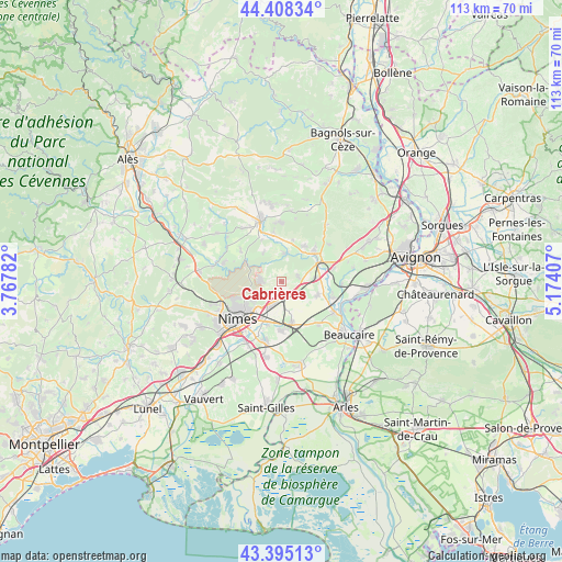
Cabrières GPS coordinates[2]
43° 54' 14.004" North, 4° 28' 15.384" East
| Map corner | latitude | longitude |
|---|---|---|
| Upper-left | 44.40834°, | 3.76782° |
| Center: | 43.90389°, | 4.47094° |
| Lower-right: | 43.39513°, | 5.17407° |
| Map W x H: | 112.7×112.7 km | = 70×70mi |
| max Lat: | 51.07786° ⇑88% North |
| Cabrières: | 43.90389° |
| min Lat: | ⇓12% South 41.3874° |
| min Long | Cabrières | max Long |
| -5.08615° | 4.47094° | 9.52242° |
| W 71.9%⇐ | ⇒28.1% E |
Elevation
Elevation of Cabrières is 143 m = 469 ft, and this is 50.7 m = 166 ft below average elevation for this country.
| Max E: |
2333 m = 7654 ft | 46.9% |
| Avg. | 193.7 m = 635 ft | |
| Cabrières | 143 m = 469 ft | |
Min E: |
-1 m = -3 ft | 53.1% |
See also: France elevation on elevation.city.
Geographical zone
Cabrières is located in North temperate zone (between Tropic of Cancer and the Arctic Circle). Distance of this Northern Tropic circle is 2275.7 km =1414.1 mi to South.| Distance of | km | miles | from Cabrières |
|---|---|---|---|
| North Pole | 5125.4 | 3184.8 | to North |
| Arctic Circle | 2519.5 | 1565.5 | to North |
| Tropic Cancer | 2275.7 | 1414.1 | to South |
| Equator | 4881.7 | 3033.3 | to South |


Nearby cities:
15 places around Cabrières: (largest is in red/bold)
• Bezouce
2.9 km =1.8 mi,  146°
146°
• Castillon-du-Gard
9.4 km =5.8 mi,  44°
44°
• Collias
5.8 km =3.6 mi,  5°
5°
• Lédenon
3.6 km =2.2 mi,  72°
72°
• Marguerittes
5.3 km =3.3 mi,  202°
202°
• Meynes
7.6 km =4.7 mi,  110°
110°
• Poulx
4.4 km =2.7 mi,  275°
275°
• Redessan
8.4 km =5.2 mi,  165°
165°
• Remoulins
8.7 km =5.4 mi,  63°
63°
• Rodilhan
9.1 km =5.7 mi, 200°
• Sagriès
9.3 km =5.8 mi,  333°
333°
• Saint-Bonnet-du-Gard
6.4 km =4 mi, 67°
• Saint-Gervasy
3 km =1.9 mi,  187°
187°
• Sernhac
6.4 km =4 mi,  82°
82°
• Vers-Pont-du-Gard
8.6 km =5.3 mi, 35°
Sources, notices
• [Note1] Compared only with cities in France existing in our database
• [Src1] Map data: © OpenStreetMap contributors (CC-BY-SA)
• [Src2] Other city data from geonames.org with taken over terms of usage.
• [Src3] Geographical zone / Annual Mean Temperature by Robert A. Rohde @ Wikipedia
