Bezouce geodata
Bezouce (Occitanie) is a populated place; located in France in Europe/Paris (GMT+2) time zone. With population of 2,116 people, there are 4548 cities with bigger population in this country. Compared to other cities in France, 88.3% of cities are located further ↑North; 72% of cities are located further ←West and 71.4% of cities have higher elevation than Bezouce. Note1
Administrative division(s):
- Level 1: Occitanie
- Level 2: Gard
- Level 3: Arrondissement de Nîmes
- Level 4: Bezouce


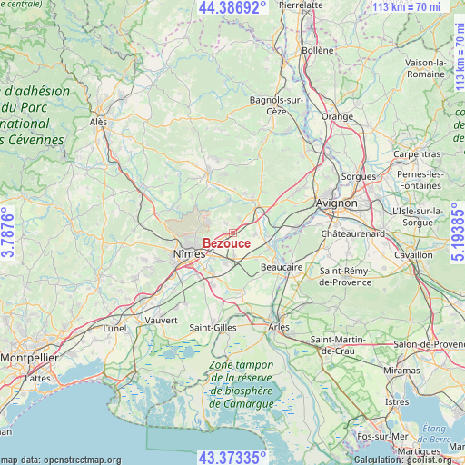
Bezouce GPS coordinates[2]
43° 52' 56.244" North, 4° 29' 26.592" East
| Map corner | latitude | longitude |
|---|---|---|
| Upper-left | 44.38692°, | 3.7876° |
| Center: | 43.88229°, | 4.49072° |
| Lower-right: | 43.37335°, | 5.19385° |
| Map W x H: | 112.7×112.7 km | = 70×70mi |
| max Lat: | 51.07786° ⇑88.3% North |
| Bezouce: | 43.88229° |
| min Lat: | ⇓11.7% South 41.3874° |
| min Long | Bezouce | max Long |
| -5.08615° | 4.49072° | 9.52242° |
| W 72%⇐ | ⇒28% E |
Elevation
Elevation of Bezouce is 75 m = 246 ft, and this is 118.7 m = 389 ft below average elevation for this country.
| Max E: |
2333 m = 7654 ft | 71.4% |
| Avg. | 193.7 m = 635 ft | |
| Bezouce | 75 m = 246 ft | |
Min E: |
-1 m = -3 ft | 28.6% |
See also: France elevation on elevation.city.
Geographical zone
Bezouce is located in North temperate zone (between Tropic of Cancer and the Arctic Circle). Distance of this Northern Tropic circle is 2273.3 km =1412.6 mi to South.| Distance of | km | miles | from Bezouce |
|---|---|---|---|
| North Pole | 5127.8 | 3186.3 | to North |
| Arctic Circle | 2521.9 | 1567 | to North |
| Tropic Cancer | 2273.3 | 1412.6 | to South |
| Equator | 4879.3 | 3031.9 | to South |


Nearby cities:
15 places around Bezouce: (largest is in red/bold)
• Cabrières
2.9 km =1.8 mi,  326°
326°
• Collias
8.2 km =5.1 mi,  352°
352°
• Jonquières-Saint-Vincent
8.4 km =5.2 mi,  136°
136°
• Lédenon
4 km =2.5 mi,  28°
28°
• Manduel
7.2 km =4.5 mi,  191°
191°
• Marguerittes
4.4 km =2.7 mi,  235°
235°
• Meynes
5.5 km =3.4 mi,  92°
92°
• Montfrin
8.8 km =5.5 mi, 94°
• Poulx
6.6 km =4.1 mi,  295°
295°
• Redessan
5.7 km =3.5 mi,  174°
174°
• Remoulins
8.9 km =5.5 mi,  44°
44°
• Rodilhan
7.8 km =4.8 mi,  218°
218°
• Saint-Bonnet-du-Gard
6.5 km =4 mi, 41°
• Saint-Gervasy
2.1 km =1.3 mi,  253°
253°
• Sernhac
5.8 km =3.6 mi,  56°
56°
Sources, notices
• [Note1] Compared only with cities in France existing in our database
• [Src1] Map data: © OpenStreetMap contributors (CC-BY-SA)
• [Src2] Other city data from geonames.org with taken over terms of usage.
• [Src3] Geographical zone / Annual Mean Temperature by Robert A. Rohde @ Wikipedia
