Buthiers geodata
Buthiers (Île-de-France) is a populated place; located in France in Europe/Paris (GMT+2) time zone. With population of 704 people, there are 11748 cities with bigger population in this country. Compared to other cities in France, 64.3% of cities are located further ↓South; 50.5% of cities are located further →East and 68.7% of cities have higher elevation than Buthiers. Note1
Administrative division(s):
- Level 1: Île-de-France
- Level 2: Seine-et-Marne
- Level 3: Arrondissement de Fontainebleau
- Level 4: Buthiers


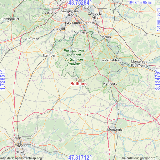
Buthiers GPS coordinates[2]
48° 17' 13.632" North, 2° 25' 53.868" East
| Map corner | latitude | longitude |
|---|---|---|
| Upper-left | 48.75284°, | 1.72851° |
| Center: | 48.28712°, | 2.43163° |
| Lower-right: | 47.81712°, | 3.13476° |
| Map W x H: | 104×104 km | = 64.6×64.6mi |
| max Lat: | 51.07786° ⇑35.7% North |
| Buthiers: | 48.28712° |
| min Lat: | ⇓64.3% South 41.3874° |
| min Long | Buthiers | max Long |
| -5.08615° | 2.43163° | 9.52242° |
| W 49.5%⇐ | ⇒50.5% E |
Elevation
Elevation of Buthiers is 81 m = 266 ft, and this is 112.7 m = 370 ft below average elevation for this country.
| Max E: |
2333 m = 7654 ft | 68.7% |
| Avg. | 193.7 m = 635 ft | |
| Buthiers | 81 m = 266 ft | |
Min E: |
-1 m = -3 ft | 31.3% |
See also: France elevation on elevation.city.
Geographical zone
Buthiers is located in North temperate zone (between Tropic of Cancer and the Arctic Circle). Distance of this North polar circle is 2032.1 km =1262.7 mi to North.| Distance of | km | miles | from Buthiers |
|---|---|---|---|
| North Pole | 4638 | 2881.9 | to North |
| Arctic Circle | 2032.1 | 1262.7 | to North |
| Tropic Cancer | 2763.1 | 1716.9 | to South |
| Equator | 5369 | 3336.1 | to South |


Nearby cities:
15 places around Buthiers: (largest is in red/bold)
• Achères-la-Forêt
12.7 km =7.9 mi,  53°
53°
• Aulnay-la-Rivière
11.8 km =7.3 mi,  203°
203°
• Briarres-sur-Essonne
6.1 km =3.8 mi,  190°
190°
• Buno-Bonnevaux
8.4 km =5.2 mi,  336°
336°
• Estouy
13.4 km =8.3 mi,  214°
214°
• Gironville-sur-Essonne
9.5 km =5.9 mi, 338°
• La Chapelle-la-Reine
10.9 km =6.8 mi,  71°
71°
• Larchant
12 km =7.5 mi,  91°
91°
• Le Vaudoué
10.1 km =6.3 mi,  39°
39°
• Maisse
12.6 km =7.8 mi, 342°
• Malesherbes
1.9 km =1.2 mi,  299°
299°
• Manchecourt
8.5 km =5.3 mi,  230°
230°
• Milly-la-Forêt
13.3 km =8.3 mi,  12°
12°
• Noisy-sur-École
10.5 km =6.5 mi,  32°
32°
• Oncy-sur-École
11 km =6.8 mi, 13°
Sources, notices
• [Note1] Compared only with cities in France existing in our database
• [Src1] Map data: © OpenStreetMap contributors (CC-BY-SA)
• [Src2] Other city data from geonames.org with taken over terms of usage.
• [Src3] Geographical zone / Annual Mean Temperature by Robert A. Rohde @ Wikipedia
