Bruay-la-Buissière geodata
Bruay-la-Buissière (Hauts-de-France) is a populated place; located in France in Europe/Paris (GMT+2) time zone. With population of 24,474 people, there are 354 cities with bigger population in this country. Compared to other cities in France, 97.1% of cities are located further ↓South; 51.4% of cities are located further ←West and 77.8% of cities have higher elevation than Bruay-la-Buissière. Note1
Administrative division(s):
- Level 1: Hauts-de-France
- Level 2: Pas-de-Calais
- Level 3: Arrondissement de Béthune
- Level 4: Bruay-la-Buissière


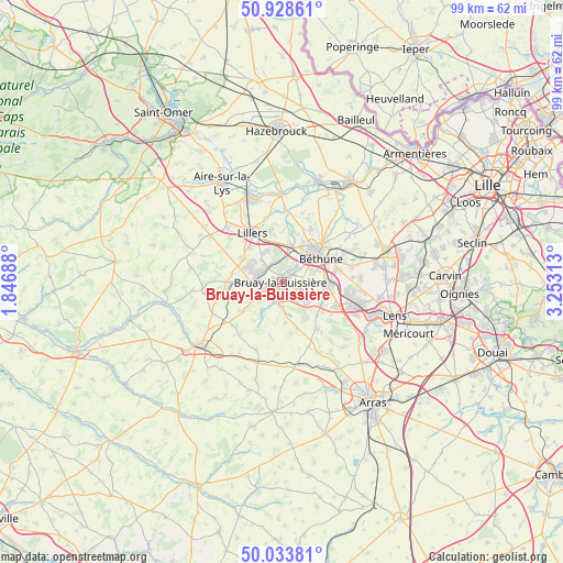
Bruay-la-Buissière GPS coordinates[2]
50° 28' 59.988" North, 2° 33' 0" East
| Map corner | latitude | longitude |
|---|---|---|
| Upper-left | 50.92861°, | 1.84688° |
| Center: | 50.48333°, | 2.55° |
| Lower-right: | 50.03381°, | 3.25313° |
| Map W x H: | 99.5×99.5 km | = 61.8×61.8mi |
| max Lat: | 51.07786° ⇑2.9% North |
| Bruay-la-Buissière: | 50.48333° |
| min Lat: | ⇓97.1% South 41.3874° |
| min Long | Bruay-la-Buissi | max Long |
| -5.08615° | 2.55° | 9.52242° |
| W 51.4%⇐ | ⇒48.6% E |
Elevation
Elevation of Bruay-la-Buissière is 60 m = 197 ft, and this is 133.7 m = 439 ft below average elevation for this country.
| Max E: |
2333 m = 7654 ft | 77.8% |
| Avg. | 193.7 m = 635 ft | |
| Bruay-la-Buissière | 60 m = 197 ft | |
Min E: |
-1 m = -3 ft | 22.2% |
See also: France elevation on elevation.city.
Geographical zone
Bruay-la-Buissière is located in North temperate zone (between Tropic of Cancer and the Arctic Circle). Distance of this North polar circle is 1788 km =1111 mi to North.| Distance of | km | miles | from Bruay-la-Buissière |
|---|---|---|---|
| North Pole | 4393.8 | 2730.2 | to North |
| Arctic Circle | 1788 | 1111 | to North |
| Tropic Cancer | 3007.3 | 1868.6 | to South |
| Equator | 5613.2 | 3487.9 | to South |


Nearby cities:
15 places around Bruay-la-Buissière: (largest is in red/bold)
• Calonne-Ricouart
5.4 km =3.4 mi,  272°
272°
• Divion
3.4 km =2.1 mi,  247°
247°
• Fouquereuil
5.3 km =3.3 mi,  41°
41°
• Gosnay
3.8 km =2.4 mi,  47°
47°
• Haillicourt
2 km =1.2 mi,  117°
117°
• Hesdigneul-lès-Béthune
3.5 km =2.2 mi, 53°
• Houchin
4.9 km =3 mi,  91°
91°
• Houdain
3.8 km =2.4 mi,  193°
193°
• Labeuvrière
4.1 km =2.5 mi,  12°
12°
• Lapugnoy
3.8 km =2.4 mi,  343°
343°
• Lozinghem
4.9 km =3 mi,  316°
316°
• Maisnil-lès-Ruitz
4.4 km =2.7 mi,  139°
139°
• Marles-les-Mines
3.8 km =2.4 mi,  309°
309°
• Ranchicourt
5.3 km =3.3 mi,  174°
174°
• Ruitz
3.3 km =2.1 mi, 124°
Sources, notices
• [Note1] Compared only with cities in France existing in our database
• [Src1] Map data: © OpenStreetMap contributors (CC-BY-SA)
• [Src2] Other city data from geonames.org with taken over terms of usage.
• [Src3] Geographical zone / Annual Mean Temperature by Robert A. Rohde @ Wikipedia
