Labeuvrière geodata
Labeuvrière (Hauts-de-France) is a populated place; located in France in Europe/Paris (GMT+2) time zone. With population of 1,759 people, there are 5383 cities with bigger population in this country. Compared to other cities in France, 97.5% of cities are located further ↓South; 51.6% of cities are located further ←West and 87.8% of cities have higher elevation than Labeuvrière. Note1
Administrative division(s):
- Level 1: Hauts-de-France
- Level 2: Pas-de-Calais
- Level 3: Arrondissement de Béthune
- Level 4: Labeuvrière


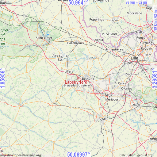
Labeuvrière GPS coordinates[2]
50° 31' 8.94" North, 2° 33' 45.648" East
| Map corner | latitude | longitude |
|---|---|---|
| Upper-left | 50.9641°, | 1.85956° |
| Center: | 50.51915°, | 2.56268° |
| Lower-right: | 50.06997°, | 3.26581° |
| Map W x H: | 99.4×99.4 km | = 61.8×61.8mi |
| max Lat: | 51.07786° ⇑2.5% North |
| Labeuvrière: | 50.51915° |
| min Lat: | ⇓97.5% South 41.3874° |
| min Long | Labeuvrière | max Long |
| -5.08615° | 2.56268° | 9.52242° |
| W 51.6%⇐ | ⇒48.4% E |
Elevation
Elevation of Labeuvrière is 35 m = 115 ft, and this is 158.7 m = 521 ft below average elevation for this country.
| Max E: |
2333 m = 7654 ft | 87.8% |
| Avg. | 193.7 m = 635 ft | |
| Labeuvrière | 35 m = 115 ft | |
Min E: |
-1 m = -3 ft | 12.2% |
See also: France elevation on elevation.city.
Geographical zone
Labeuvrière is located in North temperate zone (between Tropic of Cancer and the Arctic Circle). Distance of this North polar circle is 1784 km =1108.5 mi to North.| Distance of | km | miles | from Labeuvrière |
|---|---|---|---|
| North Pole | 4389.9 | 2727.8 | to North |
| Arctic Circle | 1784 | 1108.5 | to North |
| Tropic Cancer | 3011.3 | 1871.1 | to South |
| Equator | 5617.2 | 3490.4 | to South |


Nearby cities:
15 places around Labeuvrière: (largest is in red/bold)
• Allouagne
3.8 km =2.4 mi,  291°
291°
• Annezin
4.2 km =2.6 mi,  69°
69°
• Bruay-la-Buissière
4.1 km =2.5 mi,  192°
192°
• Chocques
2.5 km =1.6 mi,  15°
15°
• Fouquereuil
2.7 km =1.7 mi,  90°
90°
• Fouquières-lès-Béthune
3.4 km =2.1 mi,  97°
97°
• Gonnehem
4.7 km =2.9 mi,  8°
8°
• Gosnay
2.4 km =1.5 mi,  127°
127°
• Haillicourt
5 km =3.1 mi,  170°
170°
• Hesdigneul-lès-Béthune
2.7 km =1.7 mi,  135°
135°
• Lapugnoy
2 km =1.2 mi,  261°
261°
• Lozinghem
4.3 km =2.7 mi, 264°
• Marles-les-Mines
4.1 km =2.5 mi,  247°
247°
• Vaudricourt
4.9 km =3 mi,  114°
114°
• Vendin-lès-Béthune
3.5 km =2.2 mi,  48°
48°
Sources, notices
• [Note1] Compared only with cities in France existing in our database
• [Src1] Map data: © OpenStreetMap contributors (CC-BY-SA)
• [Src2] Other city data from geonames.org with taken over terms of usage.
• [Src3] Geographical zone / Annual Mean Temperature by Robert A. Rohde @ Wikipedia
