Lozinghem geodata
Lozinghem (Hauts-de-France) is a populated place; located in France in Europe/Paris (GMT+2) time zone. With population of 1,050 people, there are 8462 cities with bigger population in this country. Compared to other cities in France, 97.5% of cities are located further ↓South; 50.6% of cities are located further ←West and 74.6% of cities have higher elevation than Lozinghem. Note1
Administrative division(s):
- Level 1: Hauts-de-France
- Level 2: Pas-de-Calais
- Level 3: Arrondissement de Béthune
- Level 4: Lozinghem


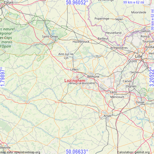
Lozinghem GPS coordinates[2]
50° 30' 55.944" North, 2° 30' 7.524" East
| Map corner | latitude | longitude |
|---|---|---|
| Upper-left | 50.96052°, | 1.79897° |
| Center: | 50.51554°, | 2.50209° |
| Lower-right: | 50.06633°, | 3.20522° |
| Map W x H: | 99.4×99.4 km | = 61.8×61.8mi |
| max Lat: | 51.07786° ⇑2.5% North |
| Lozinghem: | 50.51554° |
| min Lat: | ⇓97.5% South 41.3874° |
| min Long | Lozinghem | max Long |
| -5.08615° | 2.50209° | 9.52242° |
| W 50.6%⇐ | ⇒49.4% E |
Elevation
Elevation of Lozinghem is 68 m = 223 ft, and this is 125.7 m = 412 ft below average elevation for this country.
| Max E: |
2333 m = 7654 ft | 74.6% |
| Avg. | 193.7 m = 635 ft | |
| Lozinghem | 68 m = 223 ft | |
Min E: |
-1 m = -3 ft | 25.4% |
See also: France elevation on elevation.city.
Geographical zone
Lozinghem is located in North temperate zone (between Tropic of Cancer and the Arctic Circle). Distance of this North polar circle is 1784.4 km =1108.8 mi to North.| Distance of | km | miles | from Lozinghem |
|---|---|---|---|
| North Pole | 4390.3 | 2728 | to North |
| Arctic Circle | 1784.4 | 1108.8 | to North |
| Tropic Cancer | 3010.9 | 1870.9 | to South |
| Equator | 5616.8 | 3490.1 | to South |


Nearby cities:
15 places around Lozinghem: (largest is in red/bold)
• Allouagne
1.9 km =1.2 mi,  21°
21°
• Auchel
2.4 km =1.5 mi,  236°
236°
• Bruay-la-Buissière
4.9 km =3 mi,  136°
136°
• Burbure
3.3 km =2.1 mi,  315°
315°
• Calonne-Ricouart
4 km =2.5 mi,  210°
210°
• Camblain-Châtelain
4.9 km =3 mi,  222°
222°
• Cauchy-à-la-Tour
4.2 km =2.6 mi,  251°
251°
• Chocques
5.7 km =3.5 mi,  60°
60°
• Divion
4.9 km =3 mi,  177°
177°
• Ferfay
5.5 km =3.4 mi,  273°
273°
• Floringhem
5.8 km =3.6 mi, 248°
• Labeuvrière
4.3 km =2.7 mi,  84°
84°
• Lapugnoy
2.3 km =1.4 mi,  87°
87°
• Lillers
5.5 km =3.4 mi,  343°
343°
• Marles-les-Mines
1.3 km =0.8 mi,  158°
158°
Sources, notices
• [Note1] Compared only with cities in France existing in our database
• [Src1] Map data: © OpenStreetMap contributors (CC-BY-SA)
• [Src2] Other city data from geonames.org with taken over terms of usage.
• [Src3] Geographical zone / Annual Mean Temperature by Robert A. Rohde @ Wikipedia
