Brie geodata
Brie (Nouvelle-Aquitaine) is a populated place; located in France in Europe/Paris (GMT+2) time zone. With population of 3,490 people, there are 2786 cities with bigger population in this country. Compared to other cities in France, 70.2% of cities are located further ↑North; 75.9% of cities are located further →East and 54.1% of cities have higher elevation than Brie. Note1
Administrative division(s):
- Level 1: Nouvelle-Aquitaine
- Level 2: Charente
- Level 3: Arrondissement d’Angoulême
- Level 4: Brie


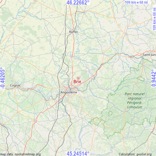
Brie GPS coordinates[2]
45° 44' 16.944" North, 0° 14' 27.852" East
| Map corner | latitude | longitude |
|---|---|---|
| Upper-left | 46.22662°, | -0.46205° |
| Center: | 45.73804°, | 0.24107° |
| Lower-right: | 45.24514°, | 0.9442° |
| Map W x H: | 109.1×109.1 km | = 67.8×67.8mi |
| max Lat: | 51.07786° ⇑70.2% North |
| Brie: | 45.73804° |
| min Lat: | ⇓29.8% South 41.3874° |
| min Long | Brie | max Long |
| -5.08615° | 0.24107° | 9.52242° |
| W 24.1%⇐ | ⇒75.9% E |
Elevation
Elevation of Brie is 119 m = 390 ft, and this is 74.7 m = 245 ft below average elevation for this country.
| Max E: |
2333 m = 7654 ft | 54.1% |
| Avg. | 193.7 m = 635 ft | |
| Brie | 119 m = 390 ft | |
Min E: |
-1 m = -3 ft | 45.9% |
See also: France elevation on elevation.city.
Geographical zone
Brie is located in North temperate zone (between Tropic of Cancer and the Arctic Circle). Distance of this North polar circle is 2315.6 km =1438.8 mi to North.| Distance of | km | miles | from Brie |
|---|---|---|---|
| North Pole | 4921.5 | 3058.1 | to North |
| Arctic Circle | 2315.6 | 1438.8 | to North |
| Tropic Cancer | 2479.7 | 1540.8 | to South |
| Equator | 5085.6 | 3160 | to South |


Nearby cities:
15 places around Brie: (largest is in red/bold)
• Agris
8.4 km =5.2 mi,  60°
60°
• Anais
4.7 km =2.9 mi,  328°
328°
• Champniers
3.9 km =2.4 mi,  227°
227°
• Gond-Pontouvre
8.4 km =5.2 mi,  223°
223°
• Jauldes
5.4 km =3.4 mi,  14°
14°
• La Rochette
9 km =5.6 mi,  39°
39°
• Magnac-sur-Touvre
8 km =5 mi,  184°
184°
• Mornac
6.4 km =4 mi,  161°
161°
• Rivières
9.5 km =5.9 mi,  79°
79°
• Ruelle-sur-Touvre
6.1 km =3.8 mi,  185°
185°
• Saint-Projet-Saint-Constant
7.6 km =4.7 mi,  98°
98°
• Tourriers
7.6 km =4.7 mi, 329°
• Touvre
8 km =5 mi, 175°
• Vars
9.4 km =5.8 mi,  286°
286°
• Vindelle
9.9 km =6.2 mi,  256°
256°
Sources, notices
• [Note1] Compared only with cities in France existing in our database
• [Src1] Map data: © OpenStreetMap contributors (CC-BY-SA)
• [Src2] Other city data from geonames.org with taken over terms of usage.
• [Src3] Geographical zone / Annual Mean Temperature by Robert A. Rohde @ Wikipedia
