Brévonnes geodata
Brévonnes (Grand Est) is a populated place; located in France in Europe/Paris (GMT+2) time zone. With population of 594 people, there are 13430 cities with bigger population in this country. Compared to other cities in France, 65.6% of cities are located further ↓South; 71.4% of cities are located further ←West and 55.9% of cities have higher elevation than Brévonnes. Note1
Administrative division(s):
- Level 1: Grand Est
- Level 2: Département de l'Aube
- Level 3: Arrondissement de Troyes
- Level 4: Brévonnes


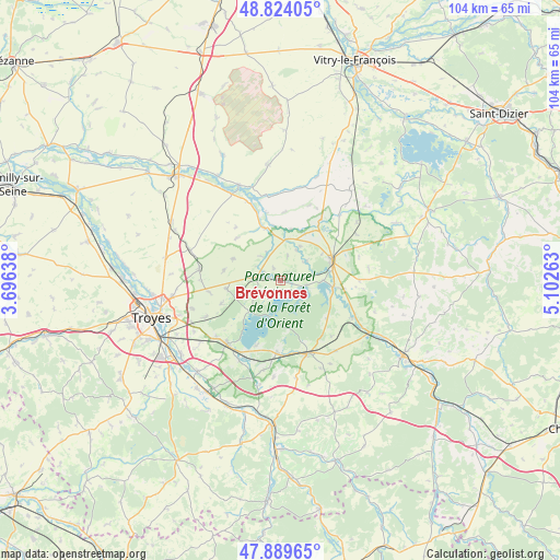
Brévonnes GPS coordinates[2]
48° 21' 32.364" North, 4° 23' 58.236" East
| Map corner | latitude | longitude |
|---|---|---|
| Upper-left | 48.82405°, | 3.69638° |
| Center: | 48.35899°, | 4.39951° |
| Lower-right: | 47.88965°, | 5.10263° |
| Map W x H: | 103.9×103.9 km | = 64.6×64.6mi |
| max Lat: | 51.07786° ⇑34.4% North |
| Brévonnes: | 48.35899° |
| min Lat: | ⇓65.6% South 41.3874° |
| min Long | Brévonnes | max Long |
| -5.08615° | 4.39951° | 9.52242° |
| W 71.4%⇐ | ⇒28.6% E |
Elevation
Elevation of Brévonnes is 114 m = 374 ft, and this is 79.7 m = 261 ft below average elevation for this country.
| Max E: |
2333 m = 7654 ft | 55.9% |
| Avg. | 193.7 m = 635 ft | |
| Brévonnes | 114 m = 374 ft | |
Min E: |
-1 m = -3 ft | 44.1% |
See also: France elevation on elevation.city.
Geographical zone
Brévonnes is located in North temperate zone (between Tropic of Cancer and the Arctic Circle). Distance of this North polar circle is 2024.2 km =1257.8 mi to North.| Distance of | km | miles | from Brévonnes |
|---|---|---|---|
| North Pole | 4630 | 2876.9 | to North |
| Arctic Circle | 2024.2 | 1257.8 | to North |
| Tropic Cancer | 2771.1 | 1721.9 | to South |
| Equator | 5377 | 3341.1 | to South |


Nearby cities:
15 places around Brévonnes: (largest is in red/bold)
• Brienne-le-Château
10.1 km =6.3 mi,  67°
67°
• Charmont-sous-Barbuise
17.6 km =10.9 mi,  287°
287°
• Chavanges
21.2 km =13.2 mi,  37°
37°
• Clérey
22.6 km =14 mi,  222°
222°
• Creney-près-Troyes
19.9 km =12.4 mi,  261°
261°
• Dienville
9.9 km =6.2 mi,  95°
95°
• Lusigny-sur-Barse
15.1 km =9.4 mi, 219°
• Montaulin
19.1 km =11.9 mi,  232°
232°
• Piney
4.9 km =3 mi,  276°
276°
• Pont-Sainte-Marie
23 km =14.3 mi, 258°
• Rouilly-Saint-Loup
21.3 km =13.2 mi,  240°
240°
• Saint-Parres-aux-Tertres
21.9 km =13.6 mi,  251°
251°
• Vendeuvre-sur-Barse
14.4 km =8.9 mi,  159°
159°
• Verrières
23.2 km =14.4 mi, 232°
• Villechétif
19.7 km =12.2 mi, 254°
Sources, notices
• [Note1] Compared only with cities in France existing in our database
• [Src1] Map data: © OpenStreetMap contributors (CC-BY-SA)
• [Src2] Other city data from geonames.org with taken over terms of usage.
• [Src3] Geographical zone / Annual Mean Temperature by Robert A. Rohde @ Wikipedia
