Brienne-le-Château geodata
Brienne-le-Château (Grand Est) is a populated place; located in France in Europe/Paris (GMT+2) time zone. With population of 3,473 people, there are 2802 cities with bigger population in this country. Compared to other cities in France, 66.2% of cities are located further ↓South; 72.3% of cities are located further ←West and 51.4% of cities have higher elevation than Brienne-le-Château. Note1
Administrative division(s):
- Level 1: Grand Est
- Level 2: Département de l'Aube
- Level 3: Arrondissement de Bar-sur-Aube
- Level 4: Brienne-le-Château


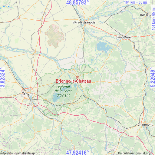
Brienne-le-Château GPS coordinates[2]
48° 23' 35.484" North, 4° 31' 34.932" East
| Map corner | latitude | longitude |
|---|---|---|
| Upper-left | 48.85793°, | 3.82324° |
| Center: | 48.39319°, | 4.52637° |
| Lower-right: | 47.92416°, | 5.22949° |
| Map W x H: | 103.8×103.8 km | = 64.5×64.5mi |
| max Lat: | 51.07786° ⇑33.8% North |
| Brienne-le-Château: | 48.39319° |
| min Lat: | ⇓66.2% South 41.3874° |
| min Long | Brienne-le-Châ | max Long |
| -5.08615° | 4.52637° | 9.52242° |
| W 72.3%⇐ | ⇒27.7% E |
Elevation
Elevation of Brienne-le-Château is 127 m = 417 ft, and this is 66.7 m = 219 ft below average elevation for this country.
| Max E: |
2333 m = 7654 ft | 51.4% |
| Avg. | 193.7 m = 635 ft | |
| Brienne-le-Château | 127 m = 417 ft | |
Min E: |
-1 m = -3 ft | 48.6% |
See also: France elevation on elevation.city.
Geographical zone
Brienne-le-Château is located in North temperate zone (between Tropic of Cancer and the Arctic Circle). Distance of this North polar circle is 2020.4 km =1255.4 mi to North.| Distance of | km | miles | from Brienne-le-Château |
|---|---|---|---|
| North Pole | 4626.2 | 2874.6 | to North |
| Arctic Circle | 2020.4 | 1255.4 | to North |
| Tropic Cancer | 2774.9 | 1724.2 | to South |
| Equator | 5380.8 | 3343.5 | to South |


Nearby cities:
15 places around Brienne-le-Château: (largest is in red/bold)
• Bar-sur-Aube
22.2 km =13.8 mi,  143°
143°
• Bayel
28.6 km =17.8 mi, 139°
• Brévonnes
10.1 km =6.3 mi,  247°
247°
• Ceffonds
19.5 km =12.1 mi,  63°
63°
• Charmont-sous-Barbuise
26.1 km =16.2 mi,  273°
273°
• Chavanges
13.4 km =8.3 mi,  15°
15°
• Dienville
4.8 km =3 mi,  173°
173°
• Laneuville-à-Rémy
27.8 km =17.3 mi,  71°
71°
• Lusigny-sur-Barse
24.5 km =15.2 mi,  230°
230°
• Montaulin
29 km =18 mi,  237°
237°
• Montier-en-Der
20.4 km =12.7 mi, 62°
• Piney
14.6 km =9.1 mi,  257°
257°
• Saint-Remy-en-Bouzemont-Saint-Genest-et-Isson
28.2 km =17.5 mi, 18°
• Sommevoire
23.4 km =14.5 mi,  85°
85°
• Vendeuvre-sur-Barse
17.8 km =11.1 mi,  193°
193°
Sources, notices
• [Note1] Compared only with cities in France existing in our database
• [Src1] Map data: © OpenStreetMap contributors (CC-BY-SA)
• [Src2] Other city data from geonames.org with taken over terms of usage.
• [Src3] Geographical zone / Annual Mean Temperature by Robert A. Rohde @ Wikipedia
