La Roche-en-Brenil geodata
La Roche-en-Brenil (Bourgogne-Franche-Comté) is a populated place; located in France in Europe/Paris (GMT+2) time zone. With population of 929 people, there are 9398 cities with bigger population in this country. Compared to other cities in France, 50.4% of cities are located further ↑North; 69.5% of cities are located further ←West and 89.7% of cities have lower elevation than La Roche-en-Brenil. Note1
Administrative division(s):
- Level 1: Bourgogne-Franche-Comté
- Level 2: Département de la Côte-d'Or
- Level 3: Arrondissement de Montbard
- Level 4: La Roche-en-Brenil


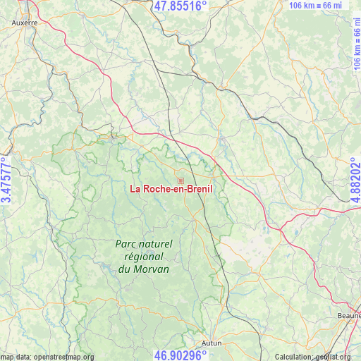
La Roche-en-Brenil GPS coordinates[2]
47° 22' 52.356" North, 4° 10' 44.004" East
| Map corner | latitude | longitude |
|---|---|---|
| Upper-left | 47.85516°, | 3.47577° |
| Center: | 47.38121°, | 4.17889° |
| Lower-right: | 46.90296°, | 4.88202° |
| Map W x H: | 105.9×105.9 km | = 65.8×65.8mi |
| max Lat: | 51.07786° ⇑50.4% North |
| La Roche-en-Brenil: | 47.38121° |
| min Lat: | ⇓49.6% South 41.3874° |
| min Long | La Roche-en-Bre | max Long |
| -5.08615° | 4.17889° | 9.52242° |
| W 69.5%⇐ | ⇒30.5% E |
Elevation
Elevation of La Roche-en-Brenil is 420 m = 1378 ft, and this is 226.3 m = 742 ft above average elevation for this country.
| Max E: |
2333 m = 7654 ft | 10.3% |
| La Roche-en-Brenil | 420 m 1378 ft | |
| Avg. | 193.7 m = 635 ft | |
Min E: |
-1 m = -3 ft | 89.7% |
See also: France elevation on elevation.city.
Geographical zone
La Roche-en-Brenil is located in North temperate zone (between Tropic of Cancer and the Arctic Circle). Distance of this North polar circle is 2132.9 km =1325.3 mi to North.| Distance of | km | miles | from La Roche-en-Brenil |
|---|---|---|---|
| North Pole | 4738.8 | 2944.6 | to North |
| Arctic Circle | 2132.9 | 1325.3 | to North |
| Tropic Cancer | 2662.4 | 1654.3 | to South |
| Equator | 5268.3 | 3273.6 | to South |


Nearby cities:
15 places around La Roche-en-Brenil: (largest is in red/bold)
• Alligny-en-Morvan
20.2 km =12.6 mi,  180°
180°
• Avallon
23.7 km =14.7 mi,  300°
300°
• Brassy
22.7 km =14.1 mi,  234°
234°
• Liernais
20.9 km =13 mi,  158°
158°
• Montsauche-les-Settons
22 km =13.7 mi,  213°
213°
• Pouillenay
25.9 km =16.1 mi,  57°
57°
• Précy-sous-Thil
9.8 km =6.1 mi,  84°
84°
• Quarré-les-Tombes
13.8 km =8.6 mi,  264°
264°
• Rouvray
7.4 km =4.6 mi,  310°
310°
• Saulieu
11.8 km =7.3 mi, 161°
• Sauvigny-le-Bois
23.2 km =14.4 mi, 309°
• Semur-en-Auxois
16.2 km =10.1 mi,  45°
45°
• Venarey-les-Laumes
27.7 km =17.2 mi, 49°
• Vitteaux
27.4 km =17 mi,  86°
86°
• Époisses
14 km =8.7 mi,  358°
358°
Sources, notices
• [Note1] Compared only with cities in France existing in our database
• [Src1] Map data: © OpenStreetMap contributors (CC-BY-SA)
• [Src2] Other city data from geonames.org with taken over terms of usage.
• [Src3] Geographical zone / Annual Mean Temperature by Robert A. Rohde @ Wikipedia
