Bozouls geodata
Bozouls (Occitanie) is a populated place; located in France in Europe/Paris (GMT+2) time zone. With population of 2,429 people, there are 3985 cities with bigger population in this country. Compared to other cities in France, 83.8% of cities are located further ↑North; 53.8% of cities are located further ←West and 94.3% of cities have lower elevation than Bozouls. Note1
Administrative division(s):
- Level 1: Occitanie
- Level 2: Département de l'Aveyron
- Level 3: Arrondissement de Rodez
- Level 4: Bozouls


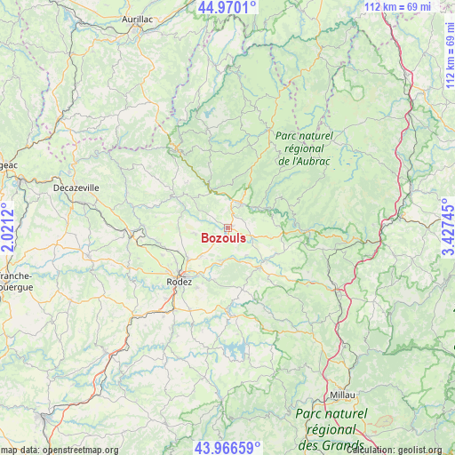
Bozouls GPS coordinates[2]
44° 28' 13.8" North, 2° 43' 27.552" East
| Map corner | latitude | longitude |
|---|---|---|
| Upper-left | 44.9701°, | 2.0212° |
| Center: | 44.4705°, | 2.72432° |
| Lower-right: | 43.96659°, | 3.42745° |
| Map W x H: | 111.6×111.6 km | = 69.3×69.3mi |
| max Lat: | 51.07786° ⇑83.8% North |
| Bozouls: | 44.4705° |
| min Lat: | ⇓16.2% South 41.3874° |
| min Long | Bozouls | max Long |
| -5.08615° | 2.72432° | 9.52242° |
| W 53.8%⇐ | ⇒46.2% E |
Elevation
Elevation of Bozouls is 553 m = 1814 ft, and this is 359.3 m = 1179 ft above average elevation for this country.
| Max E: |
2333 m = 7654 ft | 5.7% |
| Bozouls | 553 m 1814 ft | |
| Avg. | 193.7 m = 635 ft | |
Min E: |
-1 m = -3 ft | 94.3% |
See also: France elevation on elevation.city.
Geographical zone
Bozouls is located in North temperate zone (between Tropic of Cancer and the Arctic Circle). Distance of this Northern Tropic circle is 2338.7 km =1453.2 mi to South.| Distance of | km | miles | from Bozouls |
|---|---|---|---|
| North Pole | 5062.4 | 3145.6 | to North |
| Arctic Circle | 2456.5 | 1526.4 | to North |
| Tropic Cancer | 2338.7 | 1453.2 | to South |
| Equator | 4944.7 | 3072.5 | to South |


Nearby cities:
15 places around Bozouls: (largest is in red/bold)
• Bertholène
9.5 km =5.9 mi,  152°
152°
• Castelnau-de-Mandailles
14.9 km =9.3 mi,  58°
58°
• Coubisou
9.1 km =5.7 mi,  2°
2°
• Espalion
6.5 km =4 mi,  27°
27°
• Estaing
10.3 km =6.4 mi,  335°
335°
• La Loubière
11.9 km =7.4 mi,  202°
202°
• Laissac
12.6 km =7.8 mi,  142°
142°
• Le Monastère
18.4 km =11.4 mi,  218°
218°
• Le Nayrac
16.6 km =10.3 mi, 343°
• Olemps
19.5 km =12.1 mi, 224°
• Rodelle
8.3 km =5.2 mi,  286°
286°
• Rodez
17.8 km =11.1 mi, 222°
• Sainte-Radegonde
16.7 km =10.4 mi,  207°
207°
• Salles-la-Source
17.2 km =10.7 mi,  256°
256°
• Sébazac-Concourès
12.1 km =7.5 mi,  232°
232°
Sources, notices
• [Note1] Compared only with cities in France existing in our database
• [Src1] Map data: © OpenStreetMap contributors (CC-BY-SA)
• [Src2] Other city data from geonames.org with taken over terms of usage.
• [Src3] Geographical zone / Annual Mean Temperature by Robert A. Rohde @ Wikipedia
