Laissac geodata
Laissac (Occitanie) is a populated place; located in France in Europe/Paris (GMT+2) time zone. With population of 1,543 people, there are 6040 cities with bigger population in this country. Compared to other cities in France, 84.4% of cities are located further ↑North; 55.3% of cities are located further ←West and 95.2% of cities have lower elevation than Laissac. Note1
Administrative division(s):
- Level 1: Occitanie
- Level 2: Département de l'Aveyron
- Level 3: Arrondissement de Rodez
- Level 4: Laissac-Sévérac l'Église


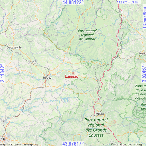
Laissac GPS coordinates[2]
44° 22' 51.06" North, 2° 49' 17.544" East
| Map corner | latitude | longitude |
|---|---|---|
| Upper-left | 44.88122°, | 2.11842° |
| Center: | 44.38085°, | 2.82154° |
| Lower-right: | 43.87617°, | 3.52467° |
| Map W x H: | 111.8×111.8 km | = 69.5×69.5mi |
| max Lat: | 51.07786° ⇑84.4% North |
| Laissac: | 44.38085° |
| min Lat: | ⇓15.6% South 41.3874° |
| min Long | Laissac | max Long |
| -5.08615° | 2.82154° | 9.52242° |
| W 55.3%⇐ | ⇒44.7% E |
Elevation
Elevation of Laissac is 596 m = 1955 ft, and this is 402.3 m = 1320 ft above average elevation for this country.
| Max E: |
2333 m = 7654 ft | 4.8% |
| Laissac | 596 m 1955 ft | |
| Avg. | 193.7 m = 635 ft | |
Min E: |
-1 m = -3 ft | 95.2% |
See also: France elevation on elevation.city.
Geographical zone
Laissac is located in North temperate zone (between Tropic of Cancer and the Arctic Circle). Distance of this Northern Tropic circle is 2328.8 km =1447 mi to South.| Distance of | km | miles | from Laissac |
|---|---|---|---|
| North Pole | 5072.4 | 3151.8 | to North |
| Arctic Circle | 2466.5 | 1532.6 | to North |
| Tropic Cancer | 2328.8 | 1447 | to South |
| Equator | 4934.7 | 3066.3 | to South |


Nearby cities:
15 places around Laissac: (largest is in red/bold)
• Bertholène
3.6 km =2.2 mi,  295°
295°
• Bozouls
12.6 km =7.8 mi,  322°
322°
• Castelnau-de-Mandailles
18.4 km =11.4 mi,  15°
15°
• Espalion
16.4 km =10.2 mi,  343°
343°
• Flavin
20 km =12.4 mi,  239°
239°
• La Loubière
12.2 km =7.6 mi,  265°
265°
• Lapanouse
17.4 km =10.8 mi,  106°
106°
• Le Monastère
19.7 km =12.2 mi,  257°
257°
• Pont-de-Salars
13.4 km =8.3 mi,  213°
213°
• Saint-Geniez-d’Olt
15.3 km =9.5 mi,  51°
51°
• Sainte-Radegonde
16.2 km =10.1 mi,  252°
252°
• Sébazac-Concourès
17.5 km =10.9 mi,  278°
278°
• Ségur
9.9 km =6.2 mi,  173°
173°
• Sévérac-le-Château
19.9 km =12.4 mi, 108°
• Vézins-de-Lévézou
15.4 km =9.6 mi,  137°
137°
Sources, notices
• [Note1] Compared only with cities in France existing in our database
• [Src1] Map data: © OpenStreetMap contributors (CC-BY-SA)
• [Src2] Other city data from geonames.org with taken over terms of usage.
• [Src3] Geographical zone / Annual Mean Temperature by Robert A. Rohde @ Wikipedia
